Win More, More Often

Equator LDI is software that Engineering, Environmental, and Survey Consultants use to win more work and get work done faster.

Trusted by Over 400 Customers

AI Tools and Commands

Work that’s out the door faster

No more staring at a blank page! With AI-powered tools, templates, and consulting-specific prompts, drafting reports is now effortless.  Learn More →

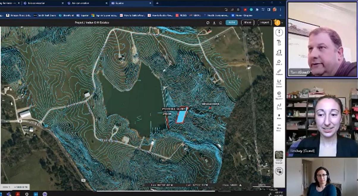
“It’s not just the scope of work [that the solution helps with], but all the design docs. I can dump 4-5 massive PDFs into Equator LDI and just start the design process. Need to know the Photometric standards, no problem, just ask Equator LDI. I have done complete property evaluations in minutes instead of days. I am just learning the best ways to apply this tool, but so far, I love it.”

– Tom, Director of Real Estate Development, WT Jones Associates

AI Proposal Automation

Proposals that win, drafted in record time

Upload past proposals and draft new proposals in minutes with our engineering consultant-specific AI models. Your data and IP is protected and never shared.  Learn More →

“Equator LDI saves me hours searching through background regulations and design manuals when preparing a scope of work”

– Tom, Director of Real Estate Development

LiDAR and Site Mapping

Costs reduced with earlier access to site data

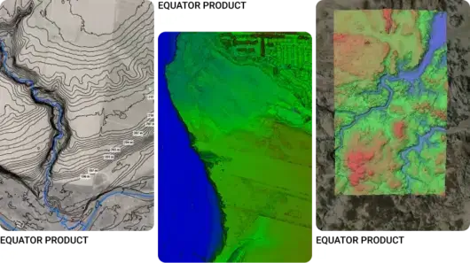
Gain deeper insights into your project site from the proposal stage with easy access to high-resolution LiDAR and topographic data.  Learn More →

“I really like Equator because I can get in there and get fast and accurate answers from LiDAR in 5 minutes.”

– Rebecca, Principal Investigator and Executive Director at Smyrnéa Archaeological Research Institute (SARI)

Our Customers’ Typical Results

↑ 3X Faster Deliverables

Faster proposals, site drawings and existing conditions models

↓ 50% Less Costs

Lower proposal, survey and design costs

Our Customer’s Typical Workflows

Our Case Studies

Explore our case studies to see how Equator Studios is helping firms win.

Ready to get started?

Join hundreds of firms using Equator Studios’ software to grow your business and achieve your best results yet. 

Frequently Asked Questions

Equator LDI stands for Equator Land Development Intelligence. It is a solution designed for civil engineering firms that uses artificial intelligence (AI), natural language processing, LiDAR, and a customer’s own content library to create high-quality proposals, documents, and reports based on user input and specific guidelines.

Are you interested in learning more about Equator LDI? Schedule a call with Equator Studios to learn more.

Equator is mapping and design software with thousands of built-in data sets.  Equator is used by civil engineers, architects, and construction professionals around the world to find, build, and share maps and designs instantly.

What is LiDAR? LiDAR is Light Detection and Ranging technology.  This technology uses a pulsed laser to measure distances from the laser to a surface.  LiDAR is often used for remote sensing applications, for example, measuring the distance to the Earth’s surface for elevation mapping.

Equator indexes data from open data portals around the world.  Many data sets are pulled in automatically through APIs and others are added by our team of GIS experts and geospatial developers.

Click the button at the top of the screen that says “LiDAR Data.” It will take you to the Equator platform where you can create a new account. You can try creating a site and adding contours, point clouds, or DEMs to your site for free.

New to Equator and trying to figure out the platform? No problem! Visit our User Guide for more information on the platform.

Interested in our latest guides relating to Proposals, RFPs, and RFQs? Check out our Academy page.

Interested in some of our free tools, such as our proposal template or checklist? Or tutorials using topographic data in various software programs, such as Civil 3D, QGIS, Sketchup, Microstation, or Rhino? Check out our Resources page.