How Rebecca uncovers hidden history with Equator and LiDAR!
About Rebecca: Founder, Principal Investigator and Executive Director
Organization: Smyrnéa Archaeological Research Institute (SARI)
Location: Florida
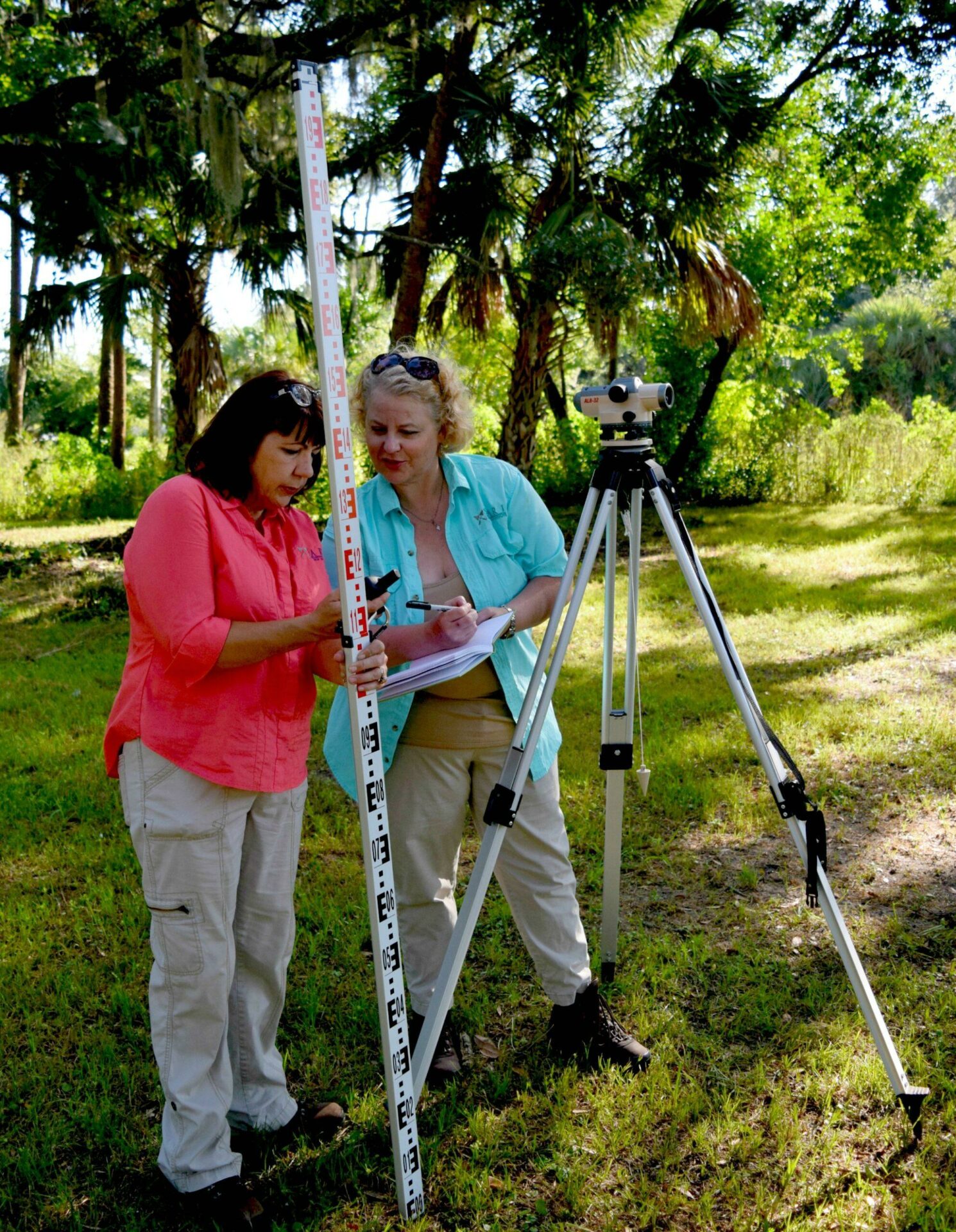
Photo credit www.nsblivingthedream.com
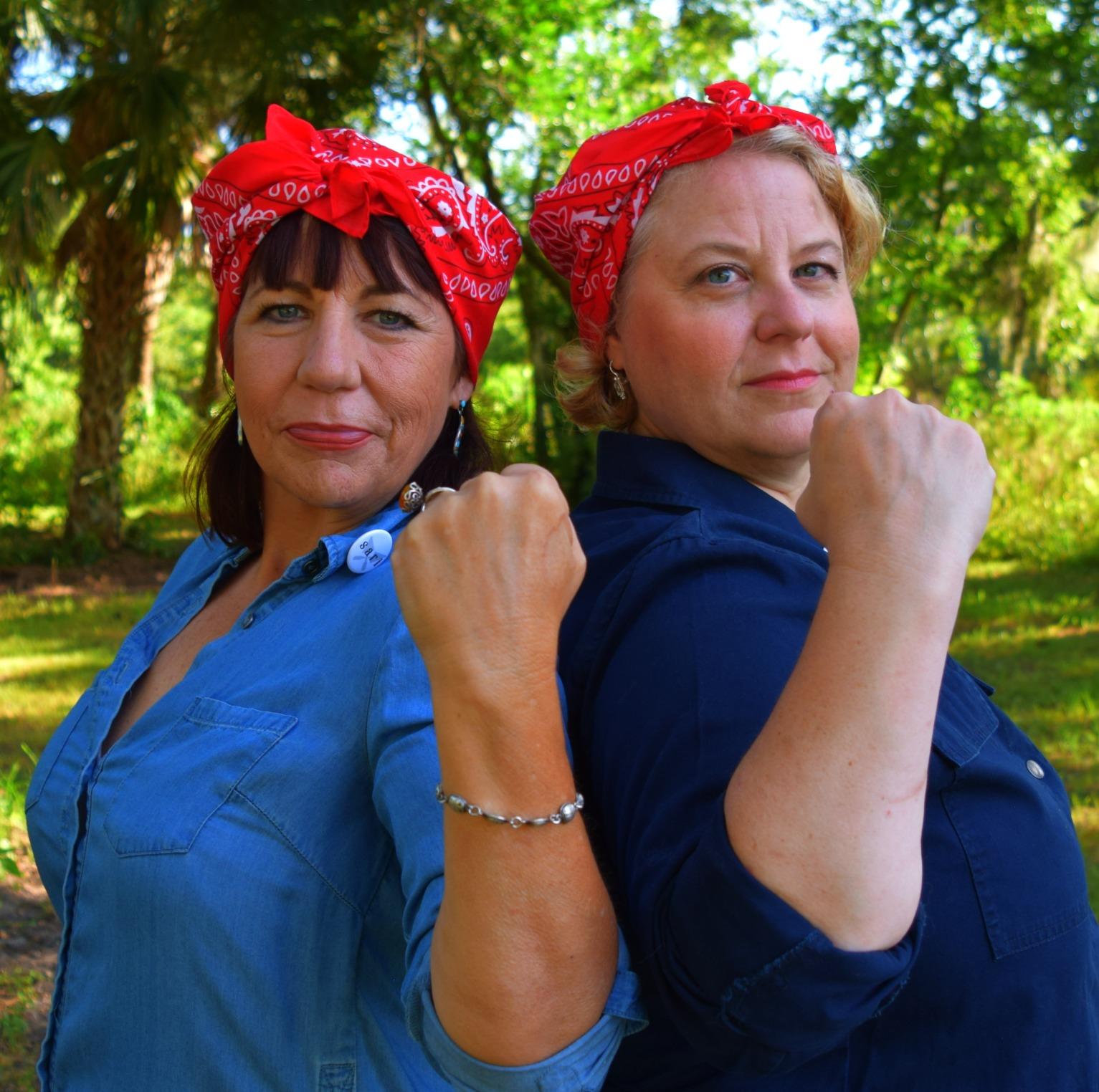
Photo credit www.nsblivingthedream.com
Meet Rebecca!
Rebecca is the founder, principal investigator and executive director of Smyrnéa Archaeological Research Institute (SARI) in New Smyrna Beach, Florida (pictured here with Vice President of Research & Historical Interpretation, Kate Wright.) Founded in 2017, SARI’s goal is to produce a physical colony map through the recording of archaeological sites in the area.
Rebecca’s Challenge:
Quickly Interpreting Massive LiDAR Data Sets
As the owner of hundreds of historic maps, Rebecca is no stranger to dealing with tons of data. Rebecca teams up with a GIS contractor who takes care of the data processing tasks. But it’s important for Rebecca, with her trained archeological-eye, to dive into and interpret the data herself.
“I’ve dealt with historic maps and documents for decades, and I know LiDAR is freely available. But I don’t have the time to invest and to get it into ArcGIS or to learn open source GIS software at this point. I wanted the shortest learning curve where I could quickly access and use the data, use it for exactly what I needed, which is archaeological prospection.”

Example of Equator being used to explore the landscape at Fig Island, with LiDAR data
Solution: Better Archaeological Prospection, with Equator
Using Equator, Rebecca is able to work with large, high resolution LiDAR data and identify topographic features that don’t conform to the natural landscape – and make exciting discoveries about history hiding in plain sight!
Using Equator provides her with a variety of tools and data at her fingertips to view and interact with data. She often uses high-resolution LiDAR (from the USGS 3DEP collection) to see into areas that are difficult to access, like private properties and densely built-up areas.
“With DEMs and LiDAR, I’m able to tell what’s natural, what’s cultural and then what we can expect when we do a site visit.”

The first day I pulled that LiDAR, I saw something on there that was like “Holy s***. What is that?” I know my town intimately, and that’s in the middle of the wood, it doesn’t make sense. And it’s right there in Equator in startling black and white. I got very excited. And so I had to go ground truth this sucker! I have to see what this is.
Rebecca, Executive Director of the Smyrnéa Archaeological Research Institute (SARI)

Example of a steam engine water tower in Hill City, South Dakota (Source: Aaron Hockley)
Uncovering a Steam Engine Water Supply with LiDAR
Rebecca was examining the LiDAR data from her town, and discovered a large square and circle formation in the middle of the woods. She went to ground truth it and found large berms in a system that ran east-west of the square with two circles. She searched for artifacts but didn’t find anything that suggested it was colonial, which is her area of interest.
She eventually discovered that it was an old water tower system from the early 20th century that was used to supply water to steam engines on the railroad. The system was designed in a way that prevented flooding in the town if it ever broke.
“That’s the true archaeological perspective – I found something, I knew it was human made, and I just had to figure out when was it created, and why?”
Current Project:
Searching for Prehistoric Burial Mounds in New Smyrna
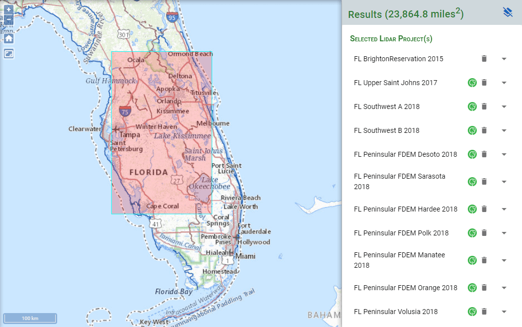
Rebecca is currently working on 10 FEMA sites, seven of which are on the beach side of the barrier islands near New Smyrna. The barrier islands are part of a ridge and swale system. In this area, prehistoric people built burial mounds and shell middens on them, sometimes on top of topographic ridges created from the last glacial period. These topographic features were cleared out for development, and the burial mounds and shell middens were not recorded before they were destroyed.
Rebecca is using one meter DEM overlaid with LiDAR in Equator to see the pattern of the ridges and identify where the burial mounds and shell middens could be located. By identifying the topographic features that are not natural, she is able to locate some of the burial mounds and shell middens that were previously unknown.

Example of a shell midden: A tree growing out of a Timucua shell mound in the Timucuan Ecological and historic preserve (Source: NP Gallery)
In Florida, it’s a game of inches and centimeters. It can mean the difference between being above water or underwater and that changing cultural landscape is really important both in the past and today. I really like Equator because I can get in there and get fast and accurate answers from the LiDAR in 5 minutes.
10x
Faster data sourcing
30K+
Users around the world
Discover with LiDAR, right from your desk!
Skip the wait and complex GIS software; start using Equator and LiDAR data instantly online, right in your browser!