How to create a Civil 3D surface from a contour shapefile?
Rebecca Swabey2024-03-25T08:44:53-04:00User Guide / How to create a Civil 3D surface from
User Guide / How to create a Civil 3D surface from
Key Mapping and GIS Terms: A Clear and Concise Glossary Updated 2023-08-23 Terms
Improving Canada's Open Data Access For the Future PSD’s Open Cities
The next generation of GIS tools: Create professional maps in minutes.
An Increase in Lidar Accuracy and what that means for Civil Engineers
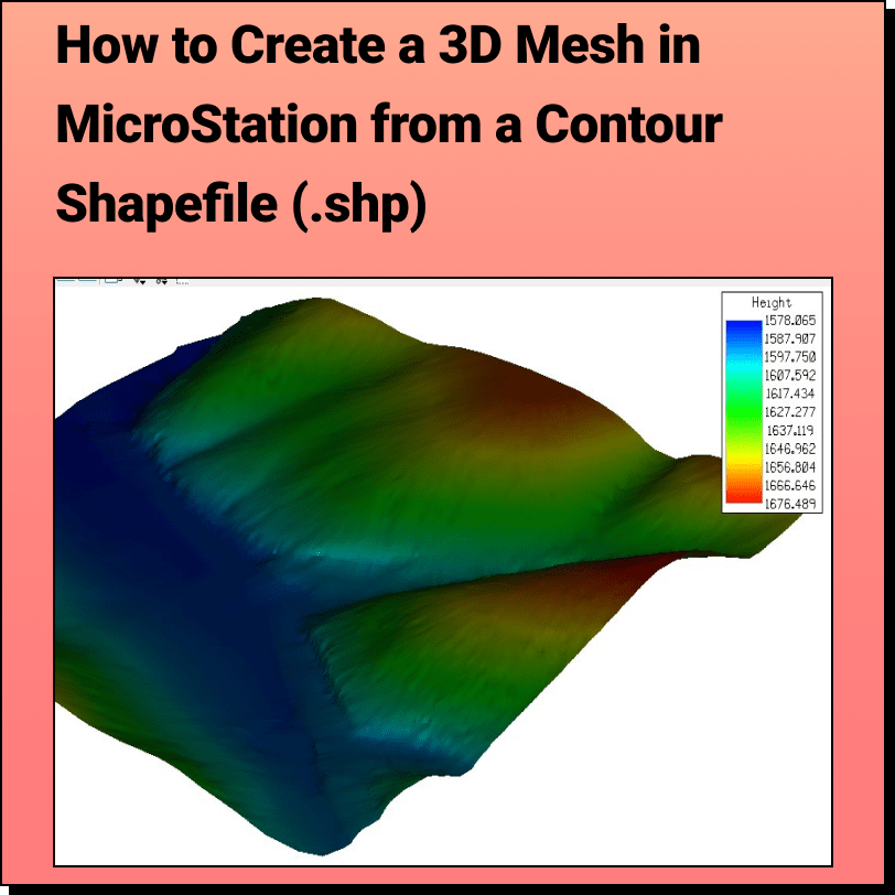
Tutorial: Creating a 3D Mesh from a Contour Shapefile in Bentley MicroStation In
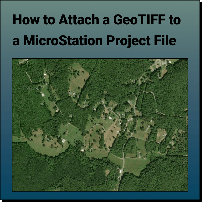
Tutorial: Attaching a RASTER (Orthoimage) to a MicroStation Project File In this tutorial,
Toronto Topographic Map The most detailed topographic map of the City of Toronto
The Future of Mapping & Spatial Design Leveraging real-time collaboration in online mapping to