Topography Products
Rebecca Swabey2024-03-25T11:03:18-04:00User Guide / Elevation Products Elevation Products
User Guide / Elevation Products Elevation Products
User Guide / Adding labels to shapefile layers
User Guide / How to create a Civil 3D surface from
User Guide / Default Base Topography (low-resolution)
User Guide / Adding and formatting markups
User Guide / Using the measurement tool
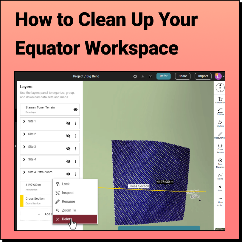
How to Clean Up the Equator Interface We get it, when you're knee