
USGS LiDAR Viewer
Equator is an easy to use viewer for the USGS lidar dataset and many others. Access billions of points from your home or office.
Join leading infrastructure designers on Equator

How does the LiDAR viewer work?
Equator has high-quality USGS LiDAR data built right in, making working with LiDAR easy! To instantly view USGS LiDAR:
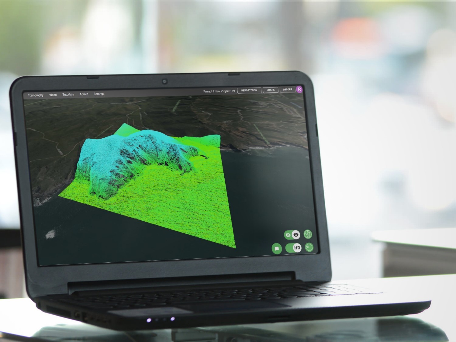
- Open the “Data Menu” tab
- Click the “+” beside Global LiDAR Availability
- Click a dataset on the map
- On the popup, click “View Now” to view the LiDAR
Or view your own LiDAR data in 3 simple steps:
- Drag and drop your .laz file into Equator
- Wait for the data to import
- Format the LiDAR data in the layer manager


New to Equator? Start Here.
Watch this YouTube tutorial video to learn more about how to use the USGS lidar viewer. In this video, we show you how to view gorgeous lidar data in 3 ways: as a point cloud, 3D surface, and as contours.

What is LiDAR data?
LiDAR (light detection and ranging) is a remote-sensing technique that uses laser light to capture the surface of the earth, often producing measurements within several centimeters of accuracy. This process creates mass point cloud datasets that can be managed, visualized, analyzed, and shared. LiDAR mapping is commonly used to support projects such as:
- Soil mapping
- Infrastructure assessment and development
- Forest modelling and management
- Land hazard/erosion mapping
- Flood control
Benefits of LiDAR data
Technology to acquire accurate and high-resolution LiDAR data is quickly improving. Now, digital elevation data can be sourced and shared in a few clicks. This allows infrastructure designers to focus on designing innovative solutions rather than spending weeks of time for collecting, formatting, and manipulating topographic data.
Equator is being used as part of the due diligence process for civil engineers, construction contractors, and real estate professionals.


What is a LAS file?
A LAS file is the file format used to store point cloud data. It contains information about each point collected, including x, y, and z coordinates, the classification of the point and the projection. The LAS format includes the full waveform data, but these files can be massive in size! This is why point clouds are often shared in LAZ file format – a compressed version of the LAS file.
LiDAR Data Classification
LiDAR data can include classifications such as: ground, buildings, vegetation and water just to name a few. Classifications are important because they define the type of object that has reflected the laser pulse.
To turn on and off points of different classification, navigate to the layer manager and click on the LiDAR layer you want to modify. Here, you will find the option to select and view points of various classification.


Cross Section from LiDAR Points
If you want to take a cross section on a LiDAR data, you can quickly do so by using the “Cross Section” tool in the top ribbon. Simply draw a section through the area of interest, then select “View Cross Section.”
Click here to learn more about topography in Equator.