Why do civil engineers, planners, and designers use Equator to create base plans?
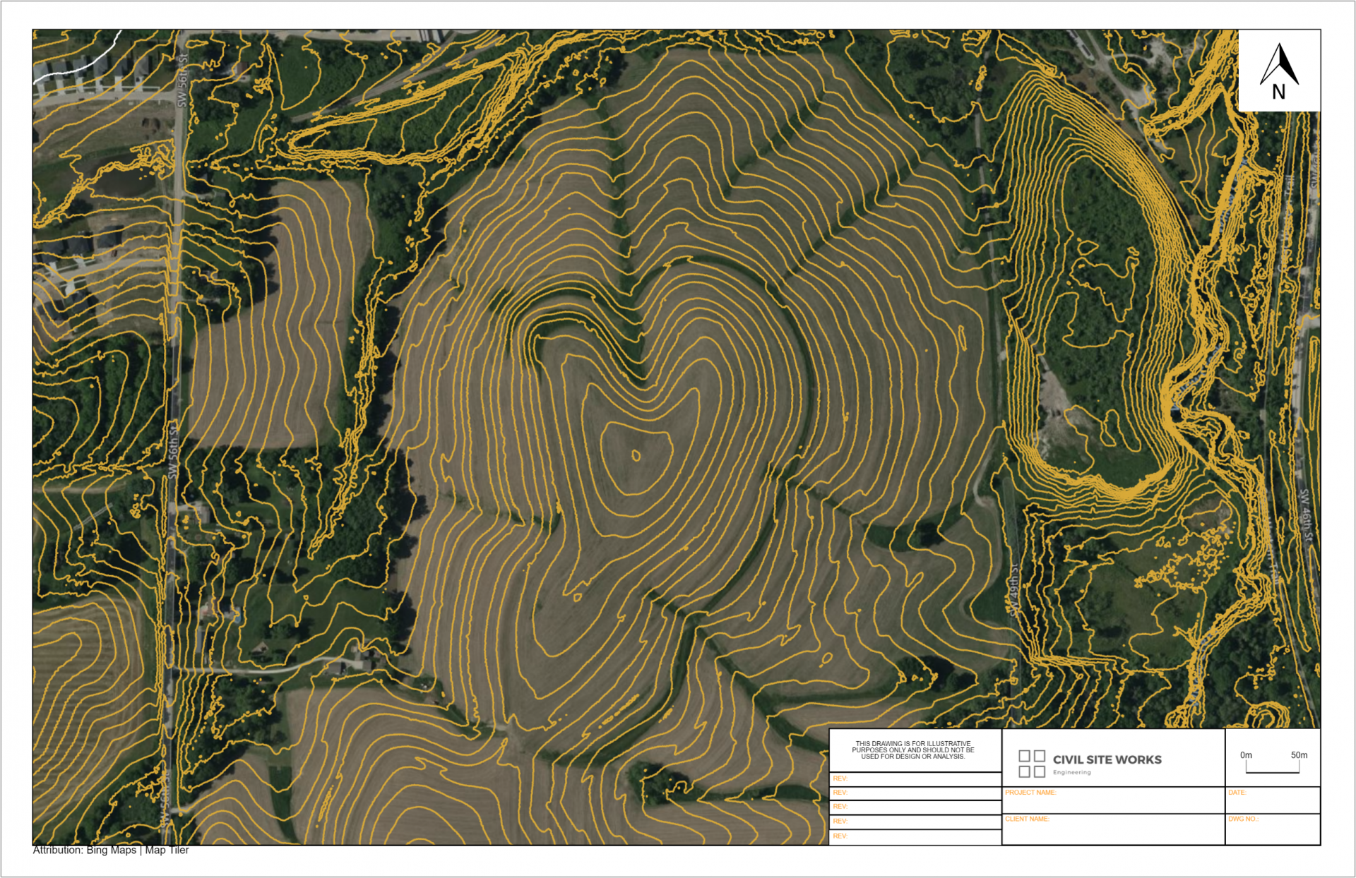
Equator provides professionals quick access to the Indiana topographic map. Using Equator, professionals can export elevation data directly into a CAD format.
Try Equator today and start saving days searching, organizing and formatting data.


Better access to elevation insights
Generate cross sections from the topography in Equator, or exported for use in other CAD software. The best available topographic data for the State of Indiana is accessible now in the Equator platform.

Where does Equator source topographic data?
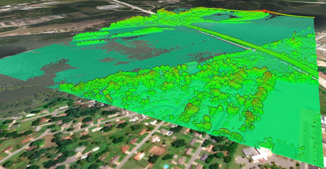
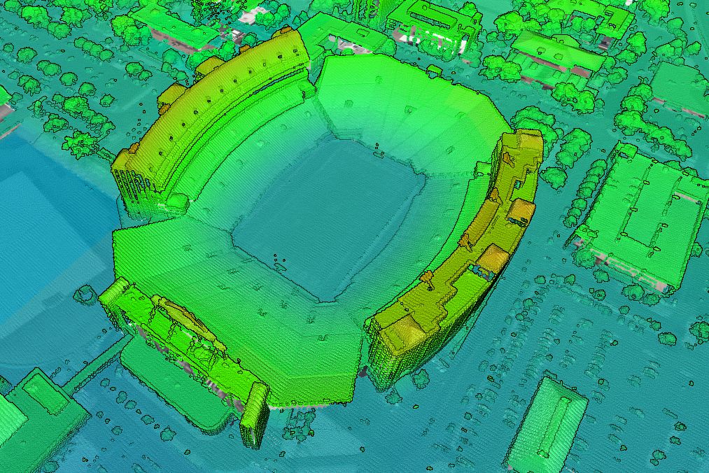
The United States Geological Survey (USGS), specifically their 3D Elevation Program (3DEP) manages the nations public LiDAR dataset. You can read more about the 3DEP here. In general, the built-in point clouds are sourced from a library of airborne LiDAR surveys that are managed by the USGS, and connected to Equator for ease of access.

Locations
Adams County
Allen County
Bartholomew County
Benton County
Blackford County
Boone County
Brown County
Carroll County
Cass County
Clark County
Clay County
Clinton County
Crawford County
Daviess County
Dearborn County
Decatur County
DeKalb County
Delaware County
Dubois County
Elkhart County
Fayette County
Floyd County
Fountain County
Franklin County
Fulton County
Gibson County
Grant County
Greene County
Hamilton County
Hancock County
Harrison County
Hendricks County
Henry County
Howard County
Huntington County
Jackson County
Jasper County
Jay County
Jefferson County
Jennings County
Johnson County
Knox County
Kosciusko County
LaGrange County
Lake County
LaPorte County
Lawrence County
Madison County
Marion County
Marshall County
Martin County
Miami County
Monroe County
Montgomery County
Morgan County
Newton County
Noble County
Ohio County
Orange County
Owen County
Parke County
Perry County
Pike County
Porter County
Posey County
Pulaski County
Putnam County
Randolph County
Ripley County
Rush County
St. Joseph County
Scott County
Shelby County
Spencer County
Starke County
Steuben County
Sullivan County
Switzerland County
Tippecanoe County
Tipton County
Union County
Vanderburgh County
Vermillion County
Vigo County
Wabash County
Warren County
Warrick County
Washington County
Wayne County
Wells County
White County
Whitley County