Experts choose us
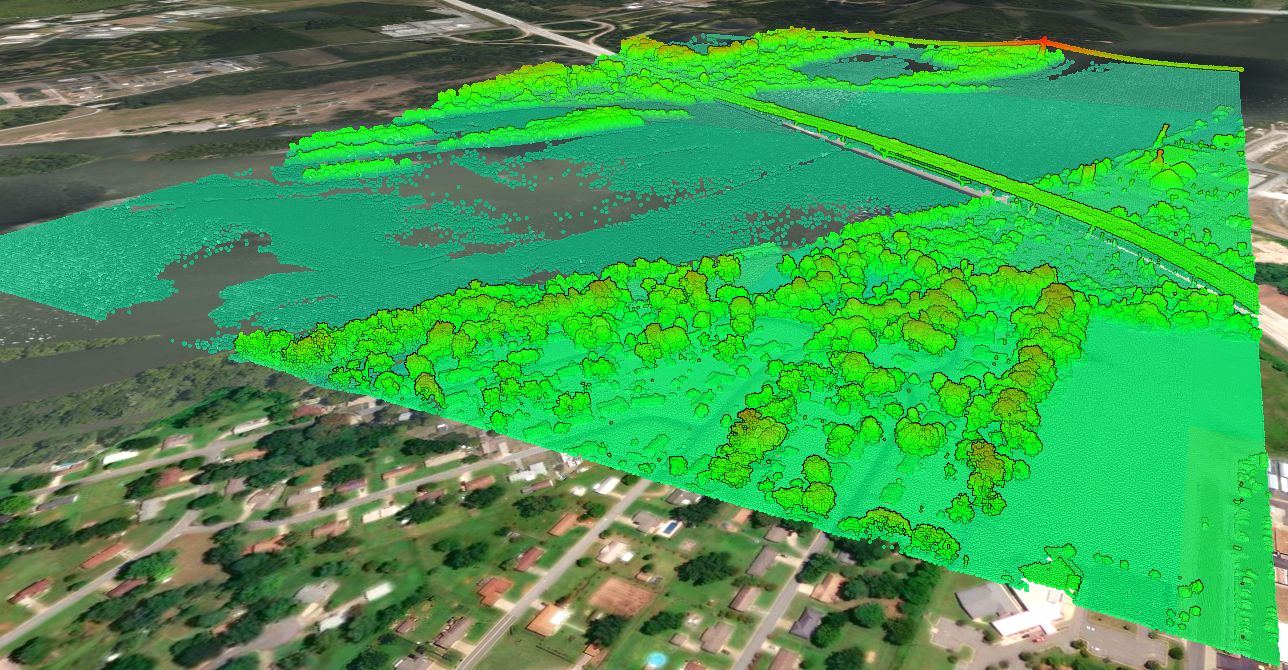
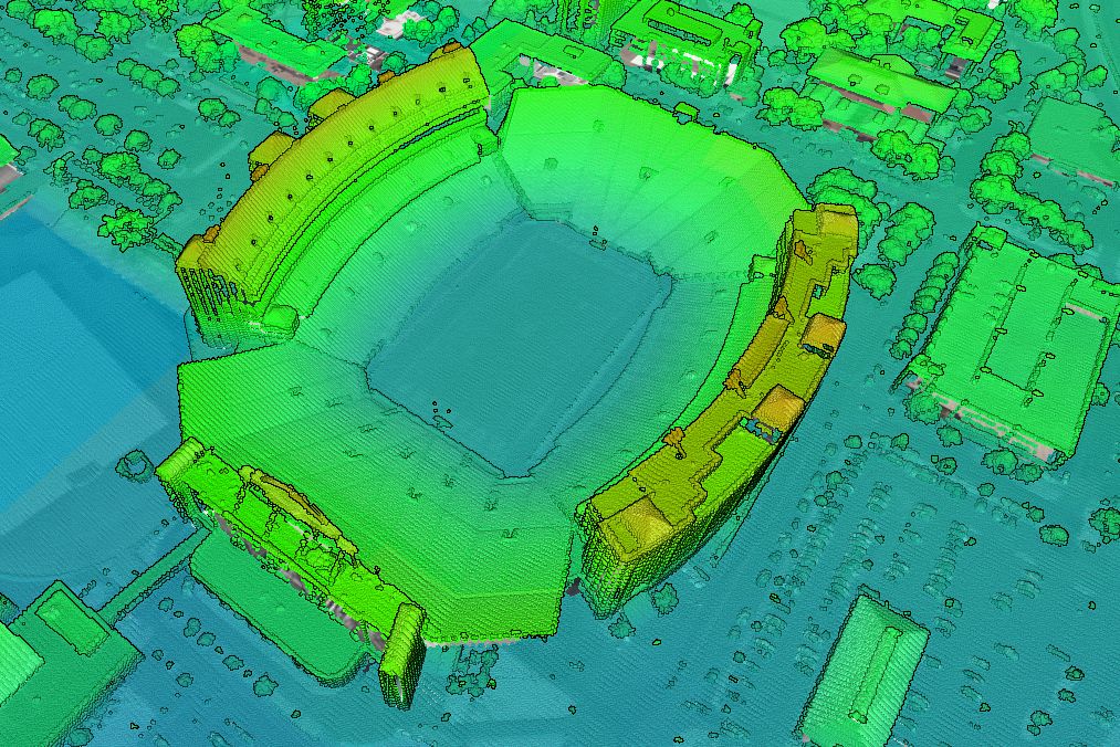
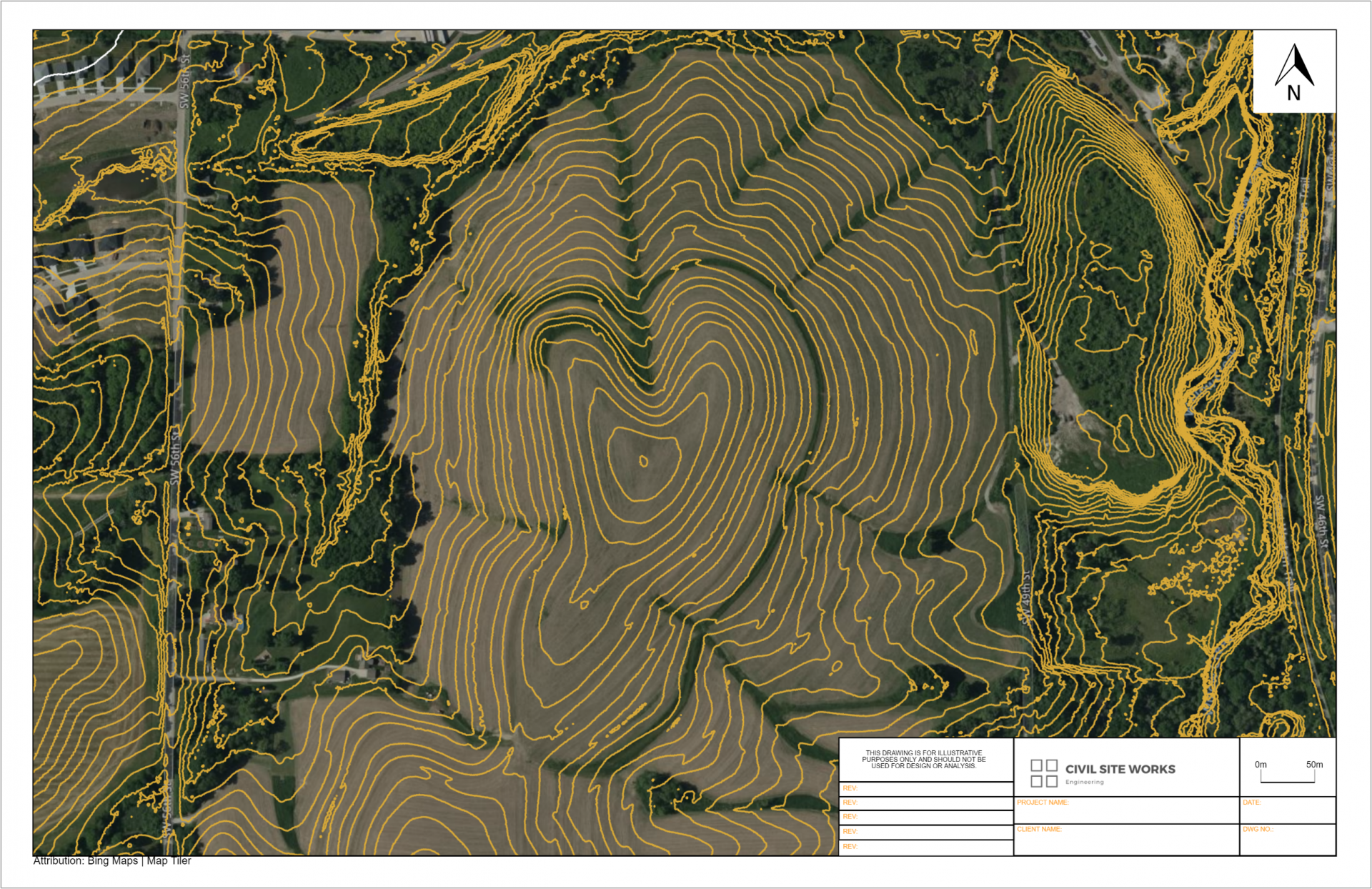
Experts use the Kansas Topographic map in Equator to view and extract elevation data. Generate Cross sections from the topography in Equator, or exported for use in other CAD software. The best available topographic data for Kansas is on the Equator map.

What data is used?
The United States Geological Survey (USGS), specifically their 3D Elevation Program (3DEP) manages the nations public LiDAR dataset. You can read more about the 3DEP here. In general, the built-in point clouds are sourced from a library of airborne LiDAR surveys that are managed by the USGS, and connected to Equator for ease of access.

Locations
Allen County
Anderson County
Atchison County
Barber County
Barton County
Bourbon County
Brown County
Butler County
Chase County
Chautauqua County
Cherokee County
Cheyenne County
Clark County
Clay County
Cloud County
Coffey County
Comanche County
Cowley County
Crawford County
Decatur County
Dickinson County
Doniphan County
Douglas County
Edwards County
Elk County
Ellis County
Ellsworth County
Finney County
Ford County
Franklin County
Geary County
Gove County
Graham County
Grant County
Gray County
Greeley County
Greenwood County
Hamilton County
Harper County
Harvey County
Haskell County
Hodgeman County
Jackson County
Jefferson County
Jewell County
Johnson County
Kearny County
Kingman County
Kiowa County
Labette County
Lane County
Leavenworth County
Lincoln County
Linn County
Logan County
Lyon County
Marion County
Marshall County
McPherson County
Meade County
Miami County
Mitchell County
Montgomery County
Morris County
Morton County
Nemaha County
Neosho County
Ness County
Norton County
Osage County
Osborne County
Ottawa County
Pawnee County
Phillips County
Pottawatomie County
Pratt County
Rawlins County
Reno County
Republic County
Rice County
Riley County
Rooks County
Rush County
Russell County
Saline County
Scott County
Sedgwick County
Seward County
Shawnee County
Sheridan County
Sherman County
Smith County
Stafford County
Stanton County
Stevens County
Sumner County
Thomas County
Trego County
Wabaunsee County
Wallace County
Washington County
Wichita County
Wilson County
Woodson County
Wyandotte County