Key Mapping and GIS Terms: A Clear and Concise Glossary
Updated 2023-08-23
Terms related to mapping and GIS can be confusing, especially if you are new to the topic. Understanding these terms is essential to realizing just how powerful a tool mapping can be. Once you understand these key words and phrases, you can use a piece of software to its full potential, or complete a project to the highest possible standard. To help you understand, here is a concise and reader-friendly glossary of key mapping terms.
Attribute
An attribute is a non-spatial characteristic of a geographic feature. They are usually stored in a labeled table for easy interpretation. Attributes can be text or numbers. For example, attributes of a lake may include name, depth, volume, or more.
Base Layer
The base layer of a map is the layer on which other layers are built. It is the “background” for any other information that is added to the map. Usually the base layer is a visual representation of the landscape, and other layers of information are added to it in the form of points, lines, and polygons.
Coordinate System
A coordinate system is a reference framework used to define the location of points on the Earth’s surface, often specified by latitude, longitude, and elevation.
Database
A database is a structured collection of data organized for efficient storage, retrieval, and manipulation. In GIS, databases store geographic and attribute data.
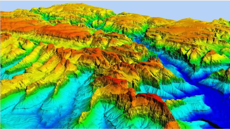
Digital Elevation Model (DEM)
A Digital Elevation Model (DEM) is a “bare earth elevation model”. This means it represents the surface of the earth without the interference of objects like trees or man-made structures. It uses color to indicate elevation, as seen in the image above.
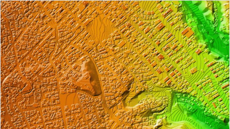
Digital Surface Model (DSM)
A Digital Surface Model (DSM) is an elevation model of the earth that includes features like trees and man-made structures. Similarly to the DEM, it also uses color to indicate elevation, as shown in the image above.
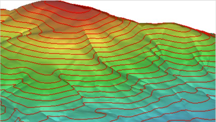
Digital Terrain Model (DTM)
A Digital Terrain Model (DTM) is similar to a DEM in that it is also a bare surface model of the earth. However, a DTM enhances terrain with lines and extra data to make the model more precise, instead of relying only on LiDAR data. An example of a DTM is shown above.
Geographic Information System (GIS)
A Geographic Information System (GIS) is a computer-based system for capturing, representing, analysing, and sharing geographic data. It can be used to find patterns or trends in data, or to apply the data to a wide variety of projects.
Georeferencing
Georeferencing is the process of aligning a raster or vector dataset with real-world geographic coordinates, enabling it to be displayed accurately in the GIS.
GeoTIFF
GeoTIFF is a standard format for geographic files. Most mapping files have two components: a visual image file, and an assortment of metadata (see below) associated with that image (for example, a coordinate system). With GeoTIFF, that georeferencing information is included in the same file as the image, so multiple files are not needed.
Layer
A layer is a set of related geographic data that can be visually represented on a map. They can use points, lines, polygons, and text labels, and they can be layered over top of each other for comparison.
Metadata
Metadata is data that in itself describes other data. For example, metadata for a map could include the map’s source, creation date, resolution, accuracy, and more.
Projection
Projection is a method used to represent the curved surface of the Earth on a flat map, preserving some properties (e.g., area, shape) while distorting others.
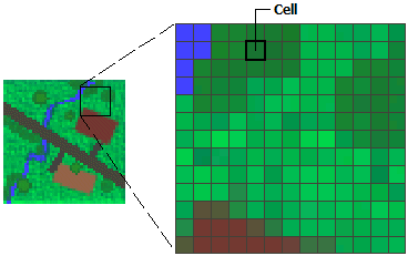
Raster
A raster is a specific model used in GIS to represent data. It consists of rectangular or square cells arranged in a regularly-sized grid of rows and/or columns.
Scale
The scale is the ratio between the size of a feature on a map and its actual size on the Earth’s surface, expressed as a fraction or ratio.
Shapefile
A shapefile is a digital vector storage format. It is used to store location data and the attribute data that goes along with it. The format can store lines, points, and polygons, but it cannot store topological information (for example, a continuous model of the surface of a hill).
Topography
Topography is the arrangement of the natural and artificial physical features of an area, including elevation, terrain, and landforms.
Vector
Vector data is a common way to represent GIS information. This data is based on coordinates and is visualized in lines, points, and polygons.
Web Map Service (WMS)
A Web Map Service (WMS) is a tool that allows someone to gain access to maps of geospatial data. The person can also view detailed information on the various features represented by the map. It is a map shared with others on a server, in the same way that ESRI, Google Maps, Bing Maps, and others share maps with the public.