Equator 3D Elevation Data Monitor

Quality Data, Without The Site Visit

Equator provides Landscape Designers with an accurate view of vegetation and topography in a central, user-friendly data portal.

“To have access to that level of accuracy early on in a project, it’s extremely valuable.”

– Ryan Albritton, Design and Foodscape Manager (St Louis, Missouri)
Landscape Design Case Study

Save Time and Add Value with Instant Access to Topographic Data 

Unprecedented, high-quality topographic maps are now available online, revolutionizing the work of Landscape Designers everywhere. For the first time, access key site insights from your desk.
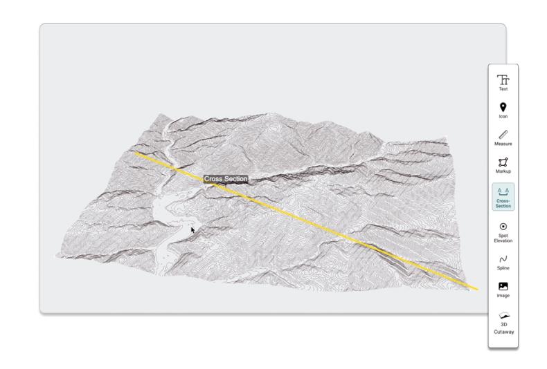
Cross Section LiDAR

Get a lay of the land, before stepping a foot on site

Get a first look of your site’s elevation in Equator with unprecedented accuracy right from the start of your project.

  • Instantly view your site in vivid detail

  • Online data portal and innovative viewer

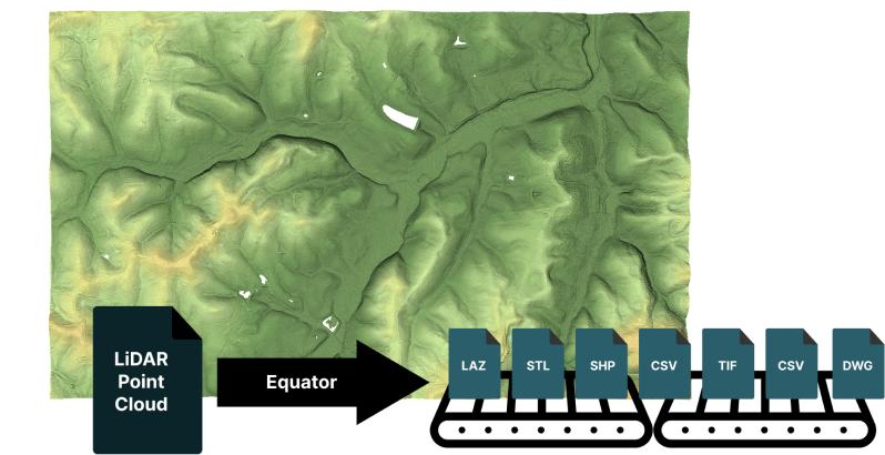
  • Generate DEMs, contours, point clouds and more!

Accurate topographic maps inspire exceptional designs

Fine-tune your drainage and planting designs with better elevation data, accurate to the centimeter.

  • Centimeter accurate topographic maps
  • Cross section, slope and elevation insights

  • Easy map making tools

Equator file types from LiDAR
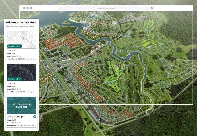
Welcome to the data menu Equator Studios

A data goldmine: one portal, limitless insights

We’ve rounded up top-notch data from trusted online sources and to make your life easier.

  • Hundreds of built-in LiDAR data sets

  • Easy-to-use user interface
  • Share maps with others online
How To

How to find the GIS data you need

Get data for landscape worflows:

  • Login or Signup for Equator

  • Create New Site

  • Add Data to your site (DEM, contours, point cloud)
  • Customize data visualization and download