Speeds up flood hazard area assessments
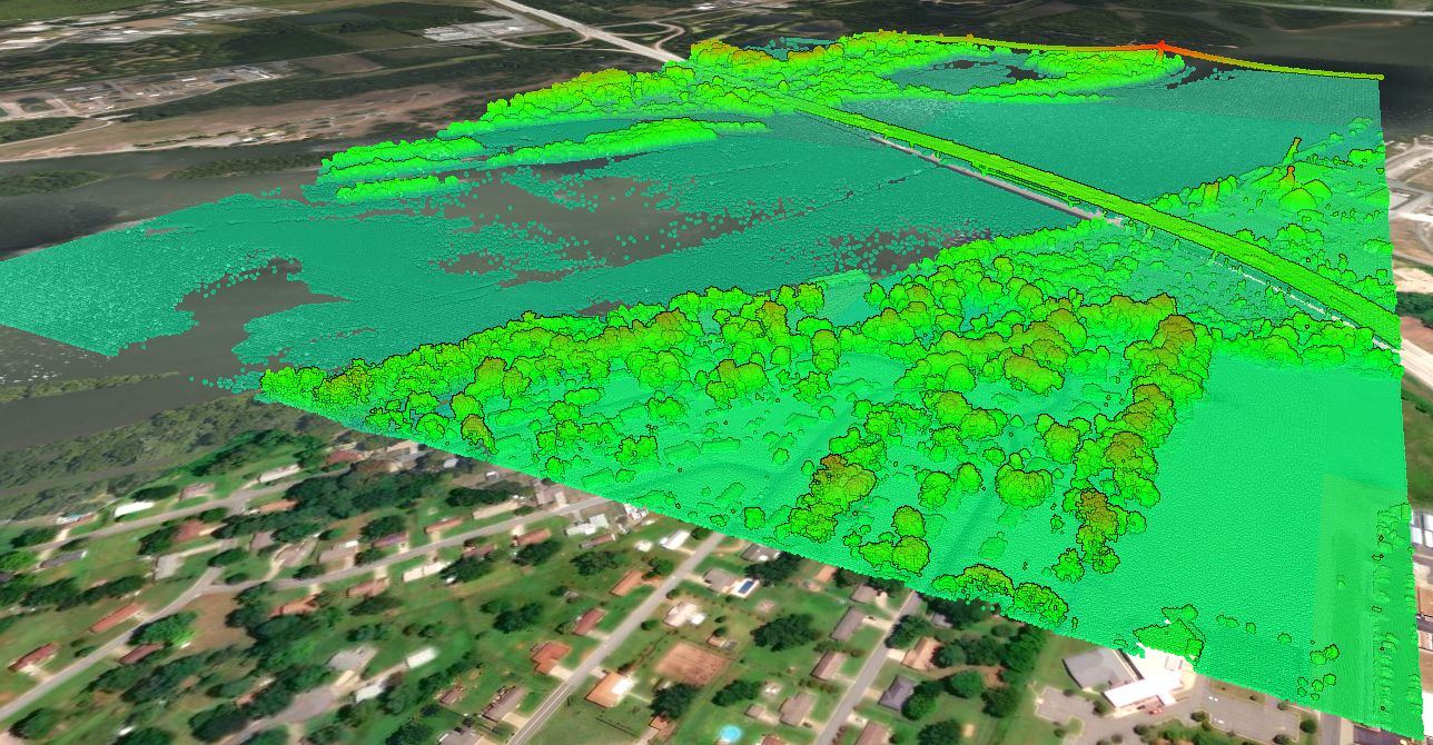
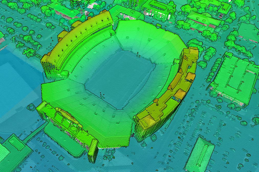
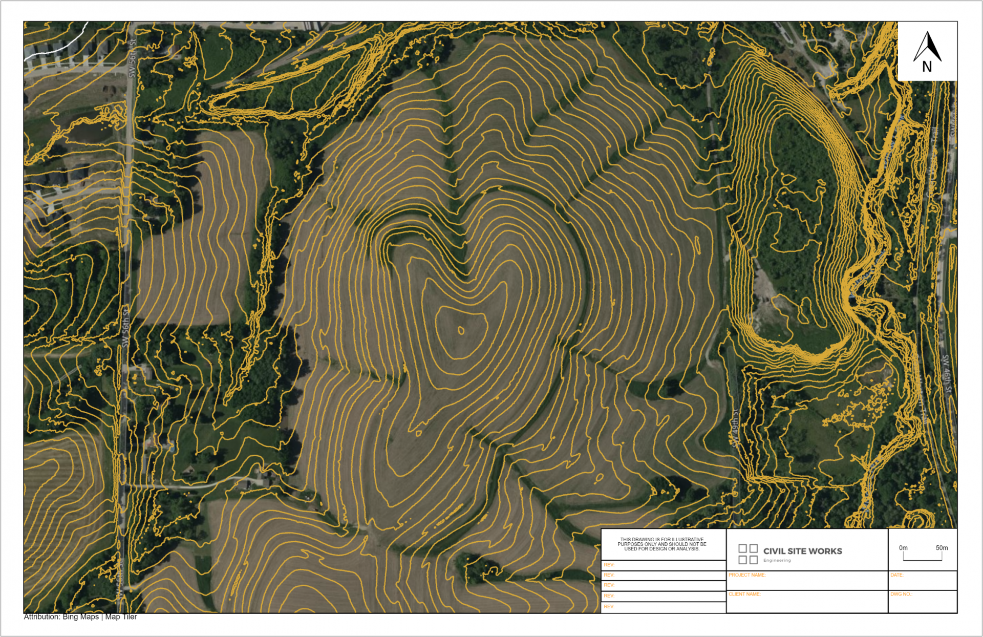
Flood experts use the Minnesota Topographic map in Equator to generate cross sections from the topography in Equator in record time. The best available topographic data for Minnesota is viewable right now in Equator.

Where does the data come from?
The United States Geological Survey (USGS), specifically their 3D Elevation Program (3DEP) manages the nations public LiDAR dataset. You can read more about the 3DEP here. In general, the built-in point clouds are sourced from a library of airborne LiDAR surveys that are managed by the USGS, and connected to Equator for ease of access.

Locations
Aitkin County
Anoka County
Becker County
Beltrami County
Benton County
Big Stone County
Blue Earth County
Brown County
Carlton County
Carver County
Cass County
Chippewa County
Chisago County
Clay County
Clearwater County
Cook County
Cottonwood County
Crow Wing County
Dakota County
Dodge County
Douglas County
Faribault County
Fillmore County
Freeborn County
Goodhue County
Grant County
Hennepin County
Houston County
Hubbard County
Isanti County
Itasca County
Jackson County
Kanabec County
Kandiyohi County
Kittson County
Koochiching County
Lac qui Parle County
Lake County
Lake of the Woods County
Le Sueur County
Lincoln County
Lyon County
McLeod County
Mahnomen County
Marshall County
Martin County
Meeker County
Mille Lacs County
Morrison County
Mower County
Murray County
Nicollet County
Nobles County
Norman County
Olmsted County
Otter Tail County
Pennington County
Pine County
Pipestone County
Polk County
Pope County
Ramsey County
Red Lake County
Redwood County
Renville County
Rice County
Rock County
Roseau County
Saint Louis County
Scott County
Sherburne County
Sibley County
Stearns County
Steele County
Stevens County
Swift County
Todd County
Traverse County
Wabasha County
Wadena County
Waseca County
Washington County
Watonwan County
Wilkin County
Winona County
Wright County
Yellow Medicine County
Union County
Van Buren County
Wapello County
Warren County
Washington County
Wayne County
Webster County
Winnebago County
Winneshiek County
Woodbury County
Worth County
Wright County