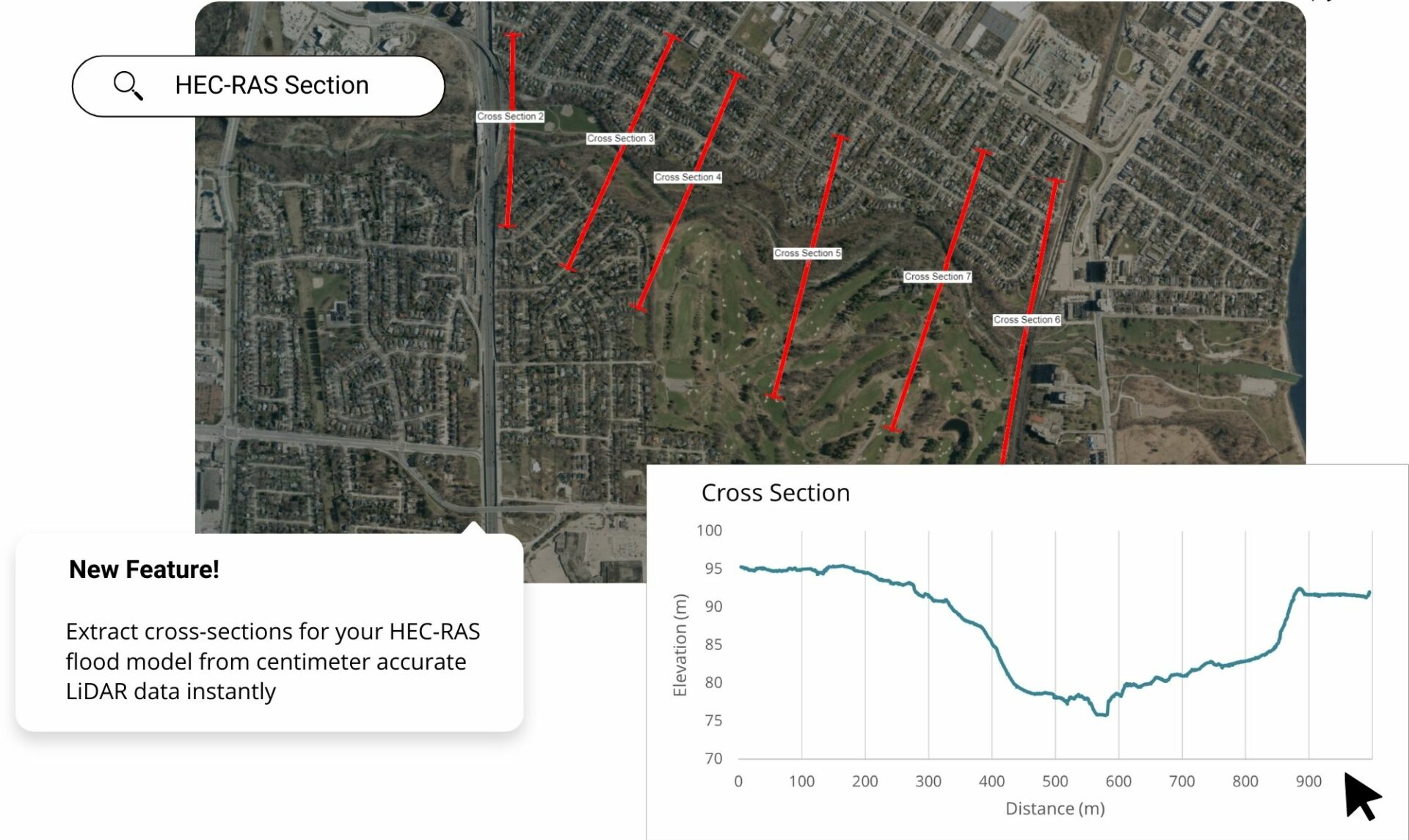
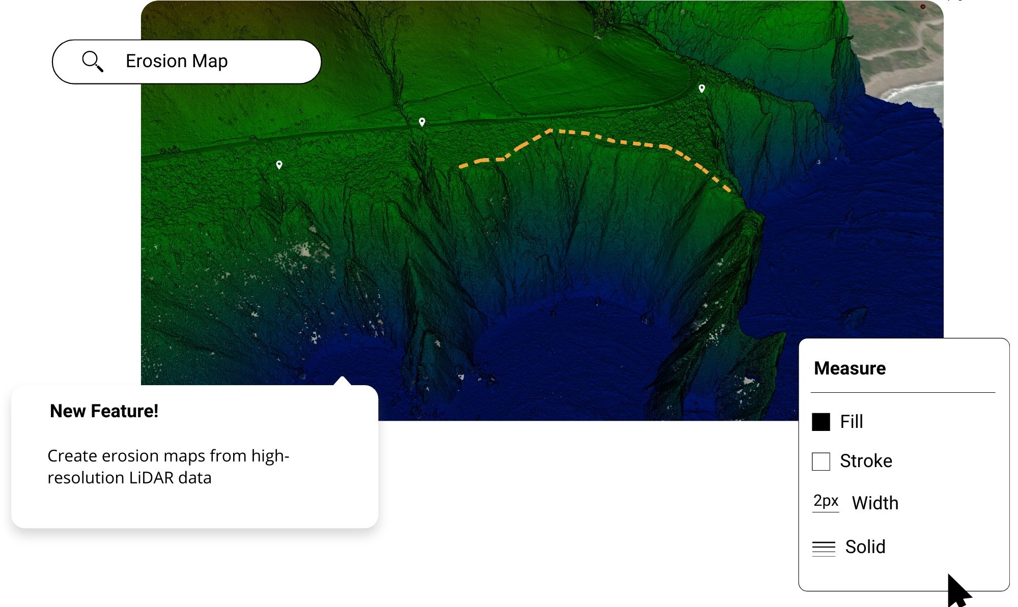
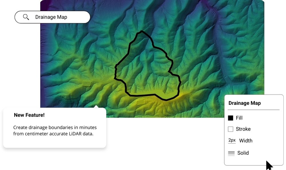
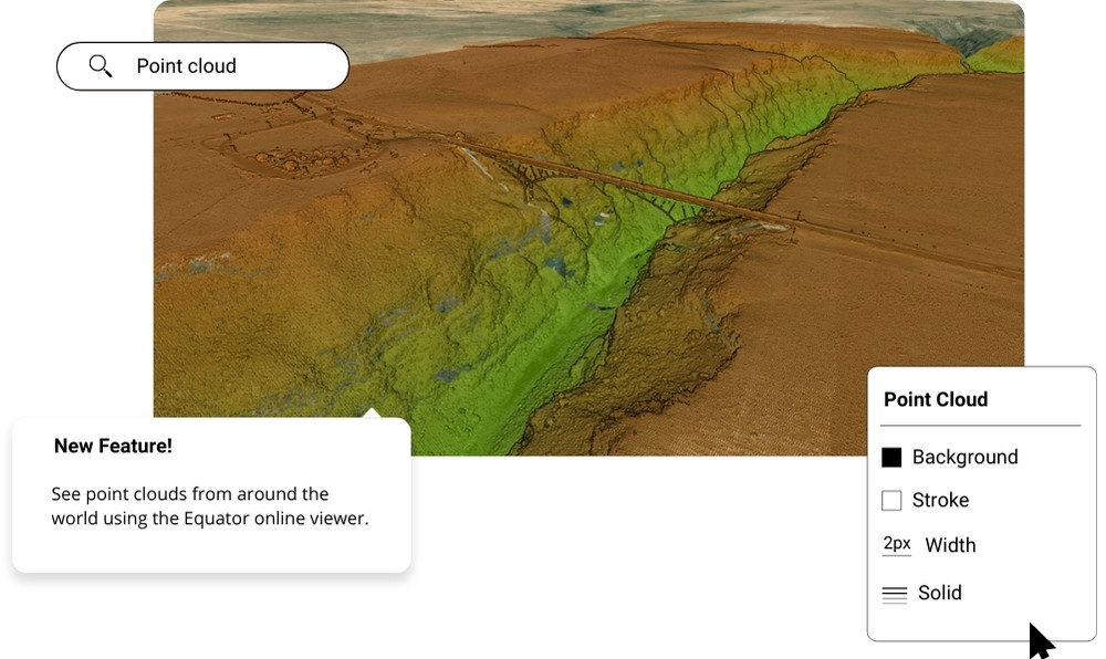
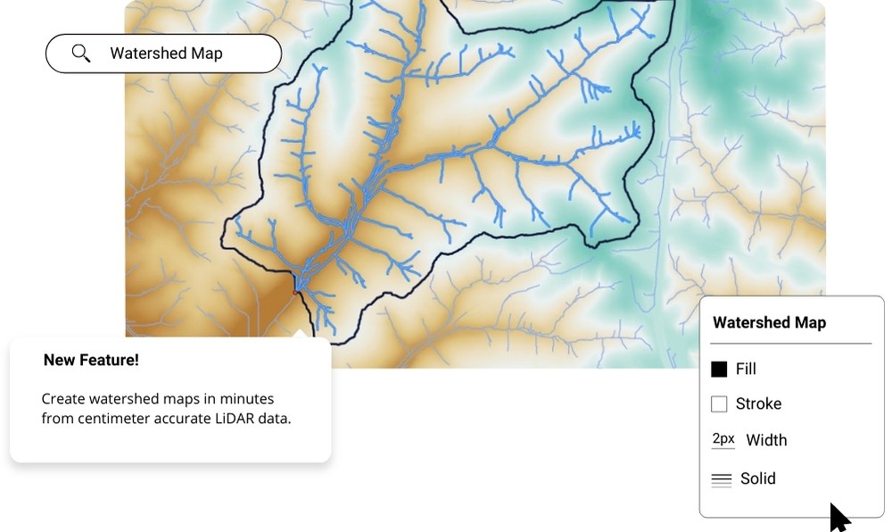
Clip DEMs Clip DEMsUse Equator to clip DEMs in minutes. Built from high-quality LiDAR point clouds to produce accurate, high resolution DEMs. Start NowChoose any location, choose the best dataWe build our DEMs from the best data available. Access our library of data and clip DEM files now. Get Data NowMetadata IncludedEvery time you clip a DEM from our platform, we will accompany the file with a Quality Report including all the metadata and additional information you might need. Get Data NowTry it now, for freeInstantly clip DEMs for use in your project. Easily share it to those who need it. A world of data is at your fingertips. Get Data NowTry Equator FreeOpen Equator RJ2024-03-24T20:58:57-04:00 Share This Article FacebookTwitterLinkedInWhatsAppTumblrPinterestVkEmail About the Author: RJ RJ does Software Development and Marketing at Equator Studios Related Posts View Parcels View Parcels March 14th, 2024 | 0 Comments The Best Map Data Online | Equator The Best Map Data Online | Equator March 14th, 2024 | 0 Comments What is Equator? – Equator Studios Mapping Software What is Equator? – Equator Studios Mapping Software March 14th, 2024 | 0 Comments HEC-RAS Cross Sections HEC-RAS Cross Sections March 13th, 2024 Erosion Mapping Erosion Mapping March 13th, 2024 Drainage Map Maker Drainage Map Maker March 13th, 2024 Point Cloud Viewer Point Cloud Viewer March 13th, 2024 Watershed Map Generator Watershed Map Generator March 13th, 2024