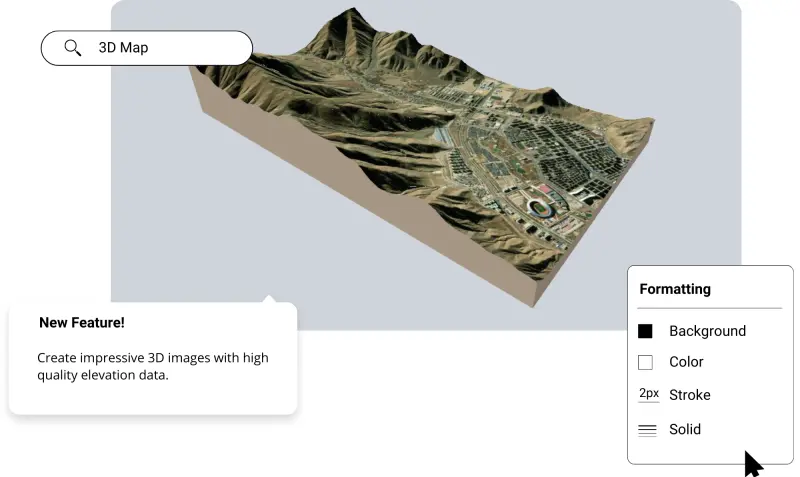
3D Map Maker

Create 3D maps and figures in minutes using the best elevation data online, in the Equator platform. Share 3D maps with others instantly.

3D Map in Equator

Join other leading designers on Equator.

Equator Layers

What is Equator?

Equator is an online map-making software for civil engineers, architects, and designers. Equator includes thousands of built-in data sets, like LiDAR and DEMs and easy-to-use design and map making tools. Create accurate, professional maps in minutes!

Create a 3D map in Equator

  • Navigate to your location of interest
  • Add contours, LiDAR, or hillshades to your site

  • Add markups, icons and measurements to your map

  • Use the 3D cutaway tool in the right insert-toolbar

  • Share your 3D maps with others online or in print

Equator GIS CAD Software Integrations

Integrate your map with other software

We’ve made it easy to integrate into your current workflow to get you up and running without friction.

Equator supports popular GIS and CAD data formats, so map layers like LiDAR can be easily exported to Civil 3D, ArcGIS, Google Earth, or other platforms.

How to Get Started

Step 1

Open Equator, a map-making platform that works in your browser.

Step 2

Create an account by signing up with your favorite email address.

Step 3

Use the built-in search engine and design tools to find elevation data and build your map.

Frequently Asked Questions

When most people think of a map, they picture a flat, two-dimensional representation of an area. But there are also maps that show the third dimension: elevation.  These 3D maps can be incredibly helpful for understanding the lay of the land and determining things like the best route to take when hiking through unfamiliar territory.   3D mapping is the process of creating a three-dimensional representation of an object or area. It can be done using various methods, including drones, LiDAR, and photogrammetry.

3D maps can be made in Equator using our design tools to customize and export the map for use elsewhere. Click here to try Equator for free.

3d maps can vary in accuracy and depend on the source data you are using to create the 3D map.  For example, making 3D maps from LiDAR in Equator can be accurate up to 10 cm.

Did you know that 3D maps are used for more than just navigation? In fact, they’re used in a variety of fields, such as engineering and urban planning. Here are three ways that 3D maps are put to use:

1. Planning and development – 3D maps can help engineers plan and model new developments, complete with accurate measurements.
2. Disaster relief – In the event of a natural disaster, 3D mapping can be used to create models of the affected area to help relief efforts.
3. Archaeology – Researchers often use 3D mapping technology to create images of archaeological sites that can be studied in detail.

As engineers, we use 3D maps for a variety of purposes. Some common applications are terrain modeling, scene rendering, and collision detection.