Join other leading designers on Equator

What can I do with Equator?
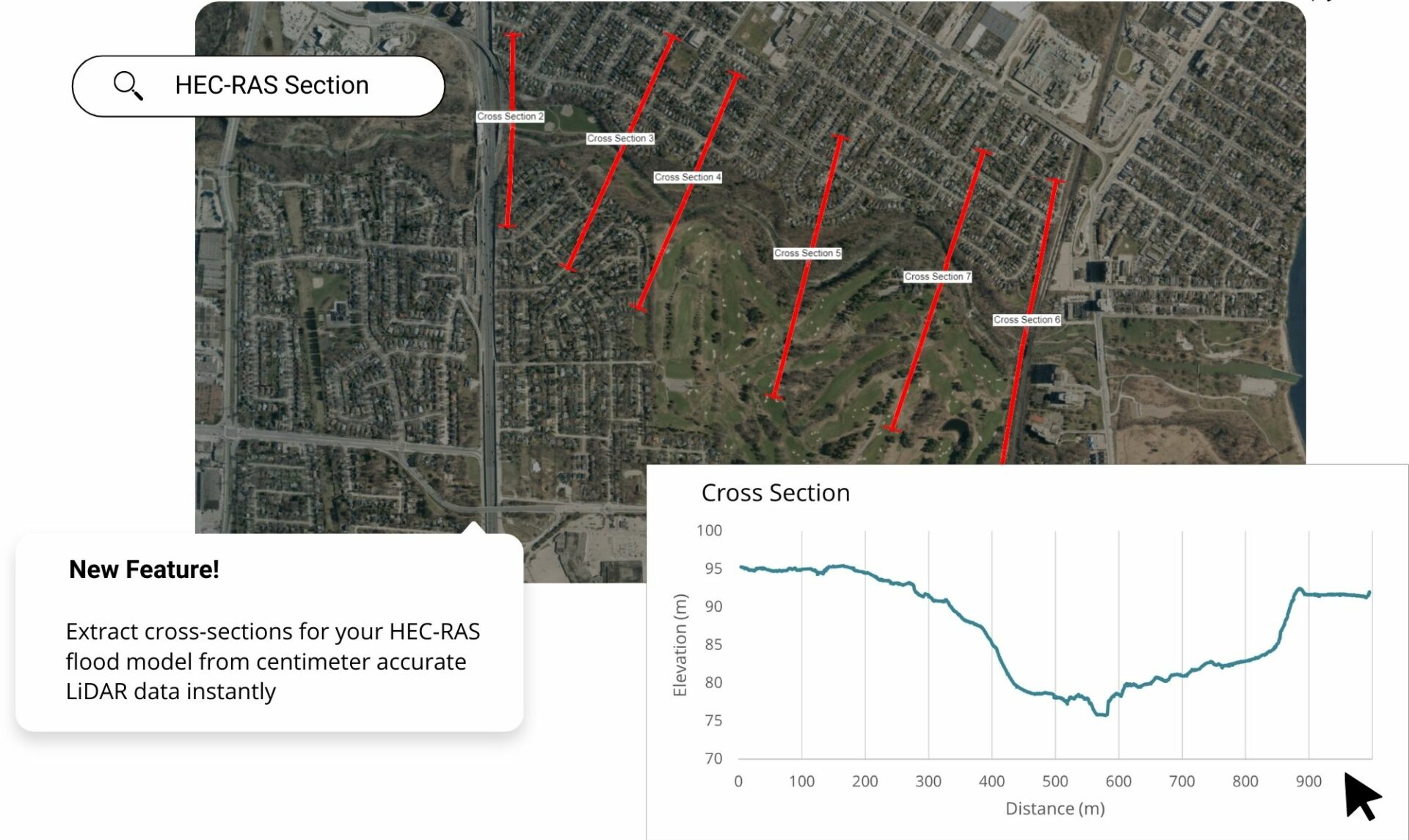
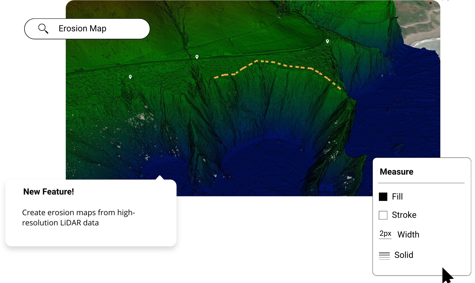
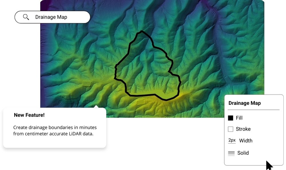
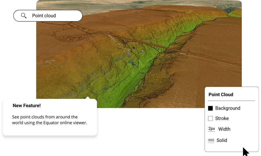
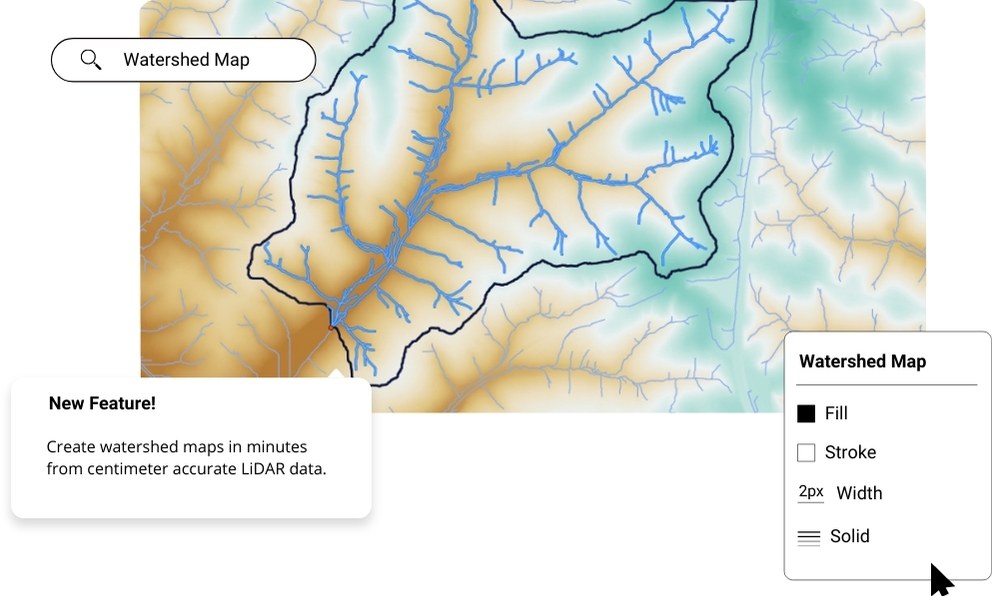
Get High Quality Elevation Data on Demand
Access LiDAR, contours and DEMs for in-depth GIS analysis. Either use the data in Equator, or export it for use in other software.
We create our contours from LiDAR. This means that your contours can be made up of hundreds of thousands of points, providing an accuracy up to a few centimeters.


Create Proposals and Reports
Using Equator to create proposals and reports is easy. Gone are the days where you need to use multiple pieces of software to complete a project.
In Equator’s report builder you can access all the tools you would need to make a finished product. Engineers who use Equator spend less time making maps, draw greater insights and win more work through their proposals.