
Online Map Maker
High quality, engineering grade data at your fingertips for your engineering, architecture or construction project.
Join leading infrastructure designers on Equator

New to Equator? Start Here.
Watch this YouTube tutorial video to learn more about how to use Equator. In this video, we show you how to view gorgeous lidar data in 3 ways: as a point cloud, 3D surface, and as contours.
Map Creator Features
Equator’s map creator has features to allow you to make professional maps and get the data you need.
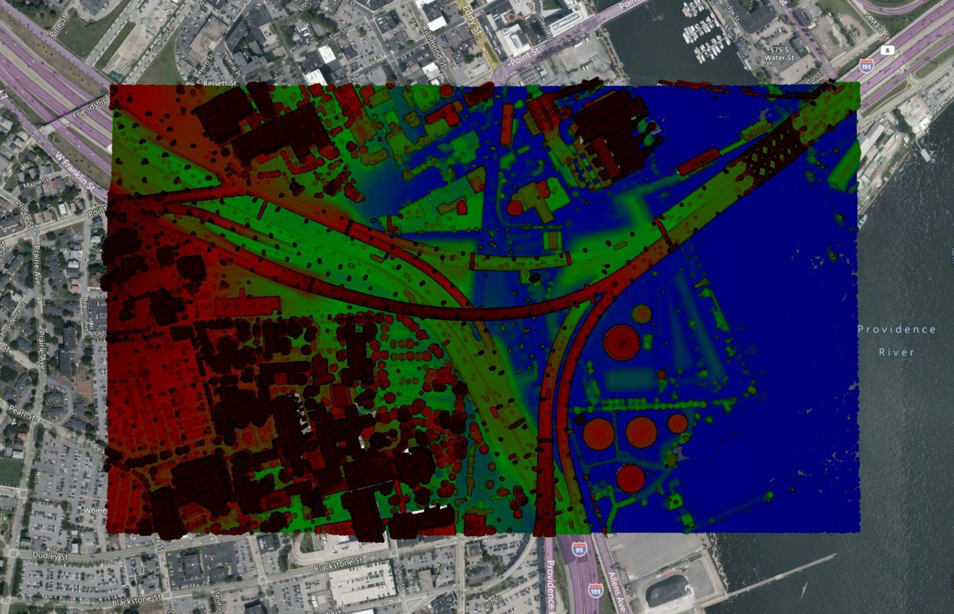
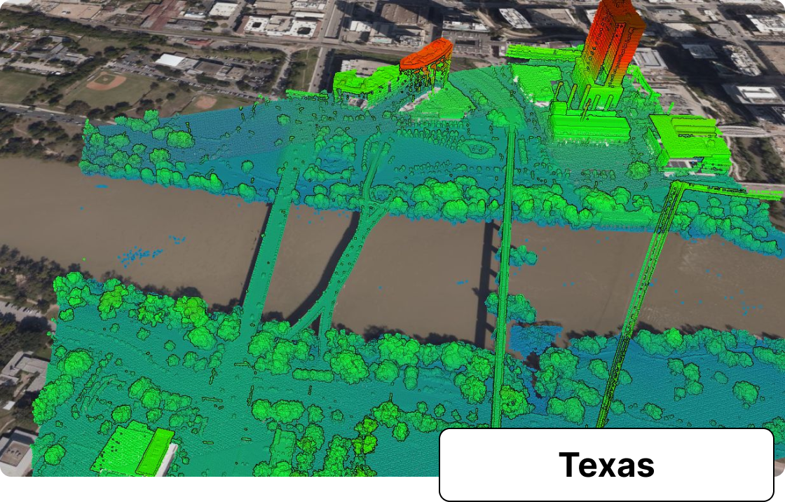
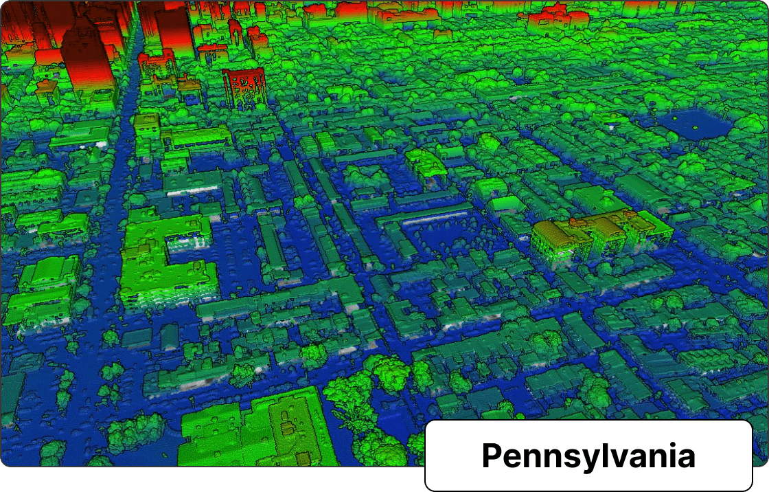
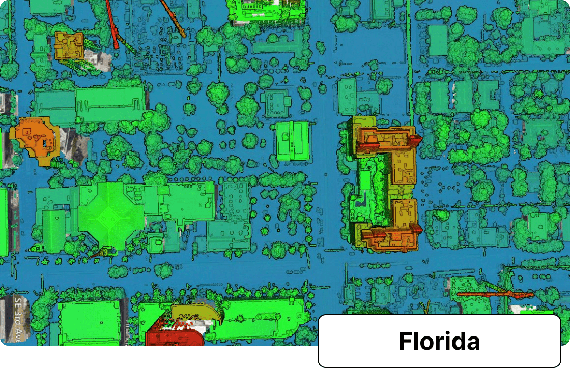
High-resolution Point Clouds
Select an area to view and export lidar point clouds from our map creator. Adjust the color, point size and other settings to customize the point cloud for your needs.
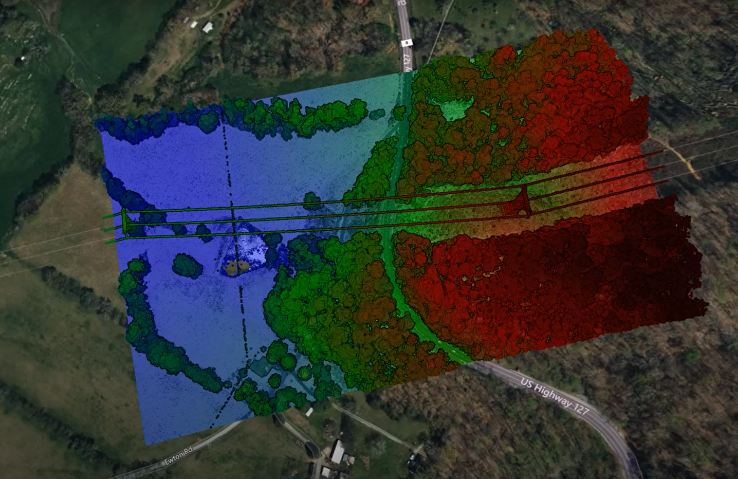
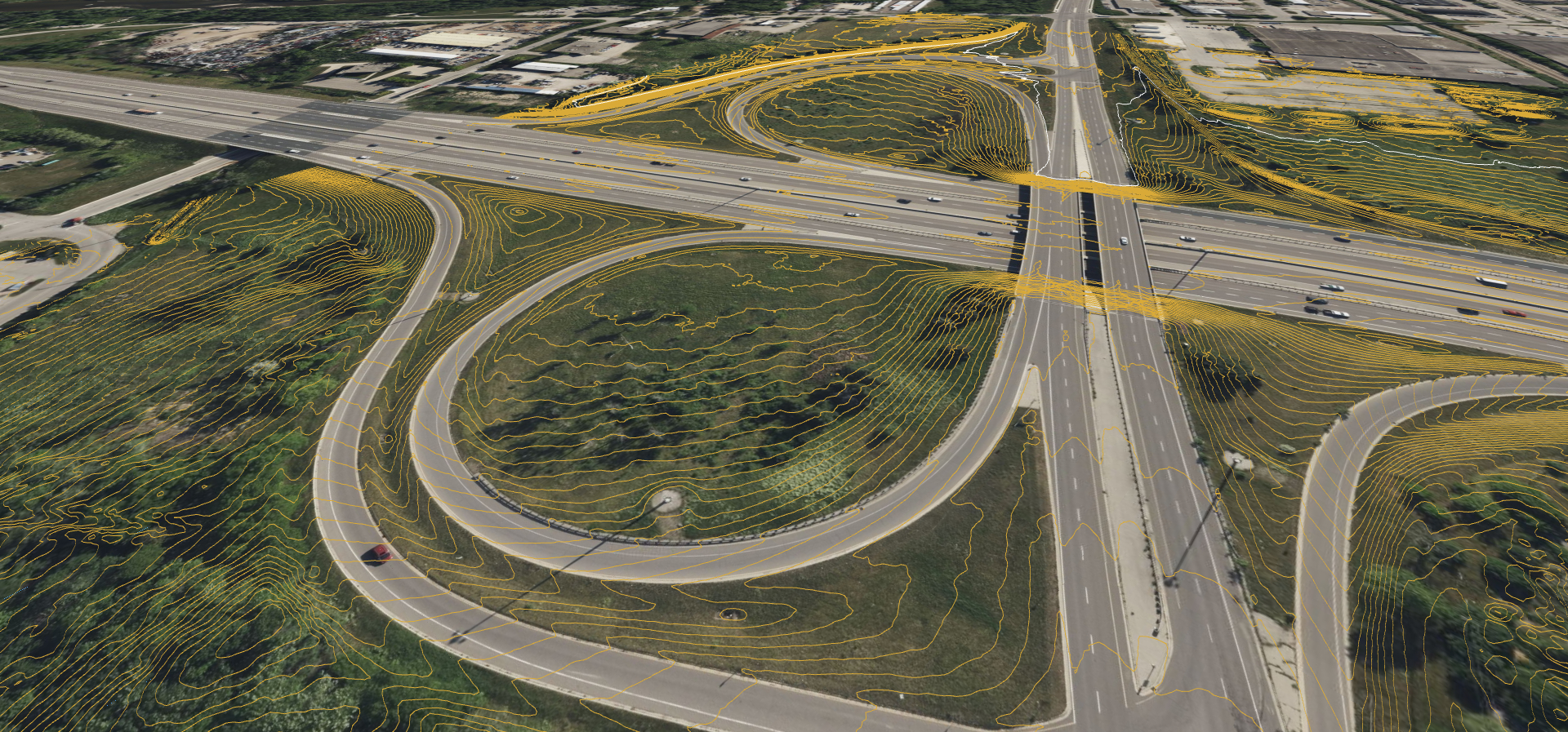
Contours with up to 1ft Intervals
Don’t miss out on the finer elevation data details. Use Equator to create contour maps. Contours generated in Equator are ready for use in other GIS software.
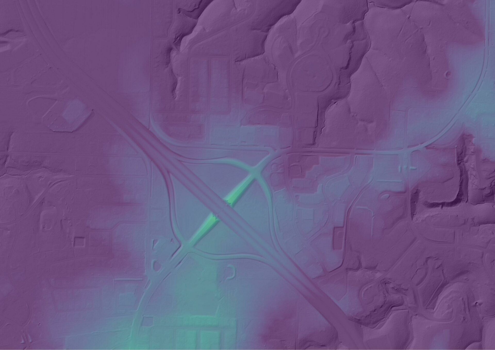
1m Digital Elevation Models (DEMs)
Produce high-quality DEMs from datasets built into the Equator platform.
Do More with Equator
Use the built-in tools to design a map for exactly what you need.
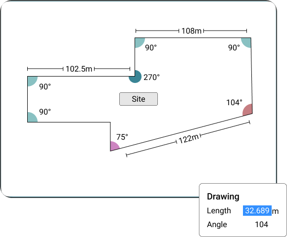
Text Annotations, Measuring, Markups
Customize your maps with text annotations and markups. Use the measuring tool to get accurate distance measurements for your engineering drawings. Use the spline tool to draw accurate curves.
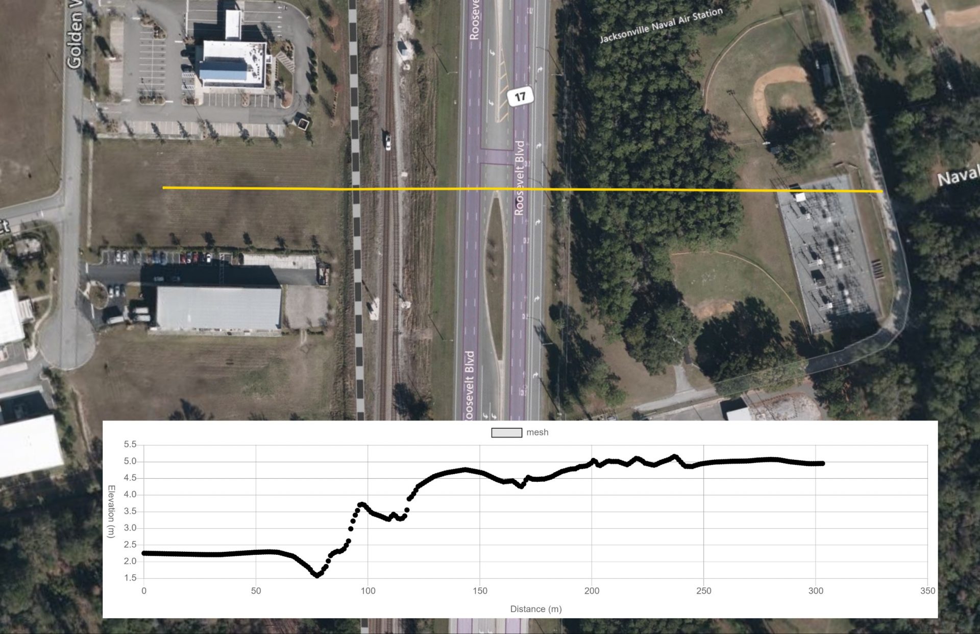
View Elevation Data with Cross Sections
Use the cross section tool to view detailed elevation data generated from our dense LiDAR point cloud data.
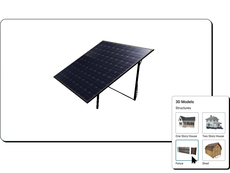
Add 3D Models
Place 3D models from our 3D model library of bushes, houses and more. Place your own custom 3D models by dragging and dropping .GLTF files onto the map.