Skip to content
  • Our Data
  • Solutions
    • High-Res Elevation Data
    • AI Digitizer for CAD (new)
    • AI Proposal Writer (coming soon)
  • Industries
    • Civil Engineering
    • Surveying
    • Landscape Design
    • Real Estate
    • Archaeology
    • 3D Design
  • Pricing
  • Resources
    • Tutorials
    • Case Studies
    • Blog
    • User Guide
  • Login
Try Now
  • Equator Topography for Revit
    Topography for Revit

Topography for Revit

Lindsay2023-11-27T21:54:44-05:00

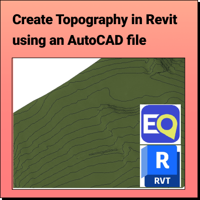
Get Topography for Revit with Equator Create a 2D contours or 3D terrain

Topography for RevitLindsay2023-11-27T21:54:44-05:00
  • topography in revit using .dwg file
    Create Topography in Revit

Create Topography in Revit

Lindsay2023-11-27T20:50:59-05:00

Create Topography in Revit Learn how to create a 3D Terrain in

Create Topography in RevitLindsay2023-11-27T20:50:59-05:00
  • Topography for Rhino 3D

Topography for Rhino 3D

Lindsay2023-11-27T19:57:42-05:00

Get Topography for Rhino with Equator Create a 3D terrain in Rhinoceros

Topography for Rhino 3DLindsay2023-11-27T19:57:42-05:00
LOCATION SPOTLIGHT
  • All Locations
  • USGS
  • Texas
  • Florida
  • Minneapolis
  • Montreal
  • Toronto
SOFTWARE INTEGRATIONS
  • ArcGIS
  • Blender
  • Civil 3D
  • HEC RAS
  • InfraWorks
  • MicroStation
  • QGIS
  • Revit
  • Rhino 3D
  • SketchUp
MAP MAKING
  • 3D Map Maker
  • Watershed Map Generator
  • Point Cloud Viewer
  • Drainage Map Maker
  • Contour Map Creator
  • Contour Map Online
  • Online Map Maker
  • Best Map Data Online
  • LiDAR Viewer
  • Shapefile Viewer
LEARN
  • User Guide
  • LiDAR Coverage Map
  • Supported File Formats
  • What is LiDAR?
  • What is a DEM?
  • What is Equator?
  • Material
COMPANY
  • Our Story
  • Contact
  • Careers
contact@equatorstudios.com

© 2023 – All rights reserved. • Equator

Page load link