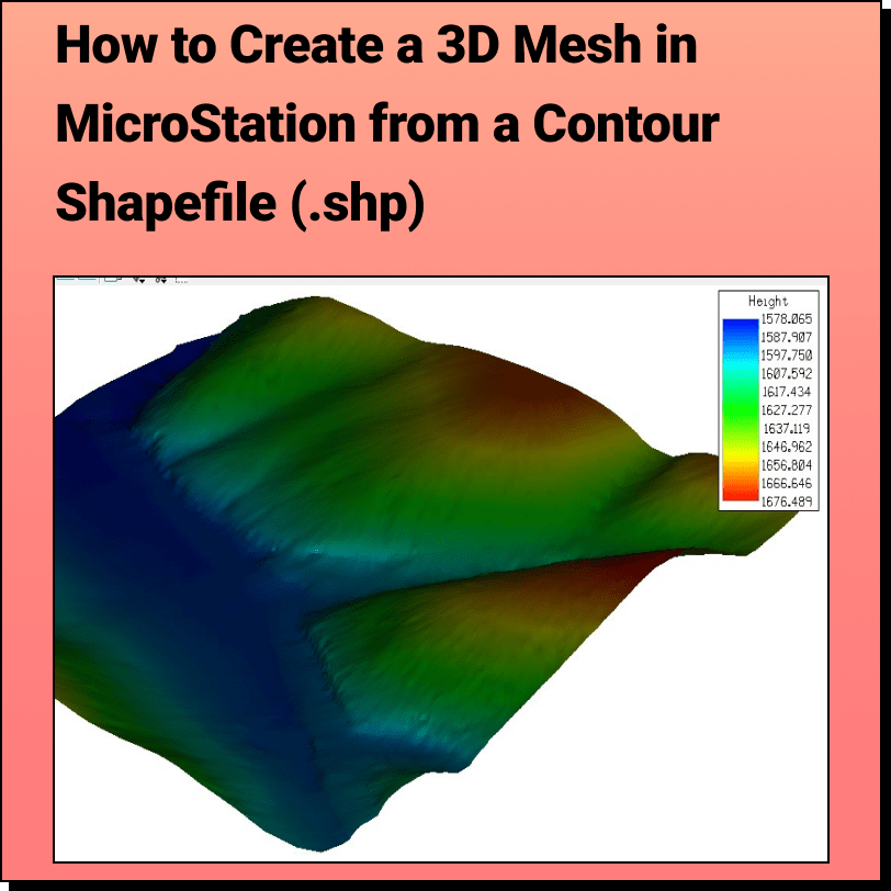
Tutorial: Creating a 3D Mesh from a Contour Shapefile in Bentley MicroStation In this tutorial, learn how to create a 3D surface mesh in MicroStation
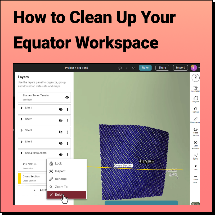
How to Clean Up the Equator Interface We get it, when you're knee deep in a project, having a clean interface isn't always a priority.
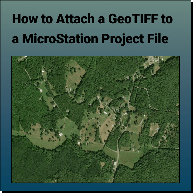
Tutorial: Attaching a RASTER (Orthoimage) to a MicroStation Project File In this tutorial, learn how to attach an orthoimage (GeoTIFF file exported from Equator) to
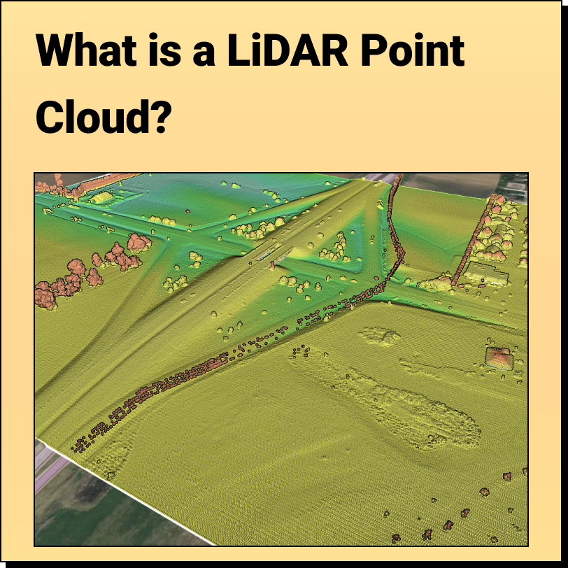
What is a LiDAR Point Cloud? What is it: A LiDAR (Light Detection and Ranging) point cloud is a collection of data
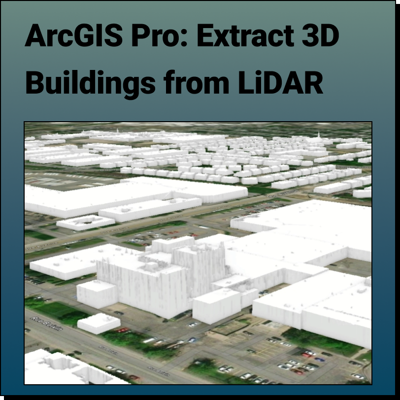
Extract 3D Buildings from LiDAR Data in ArcGIS Pro This Equator and ArcGIS Pro Tutorial guides you through how to create realistic 3D buildings using a
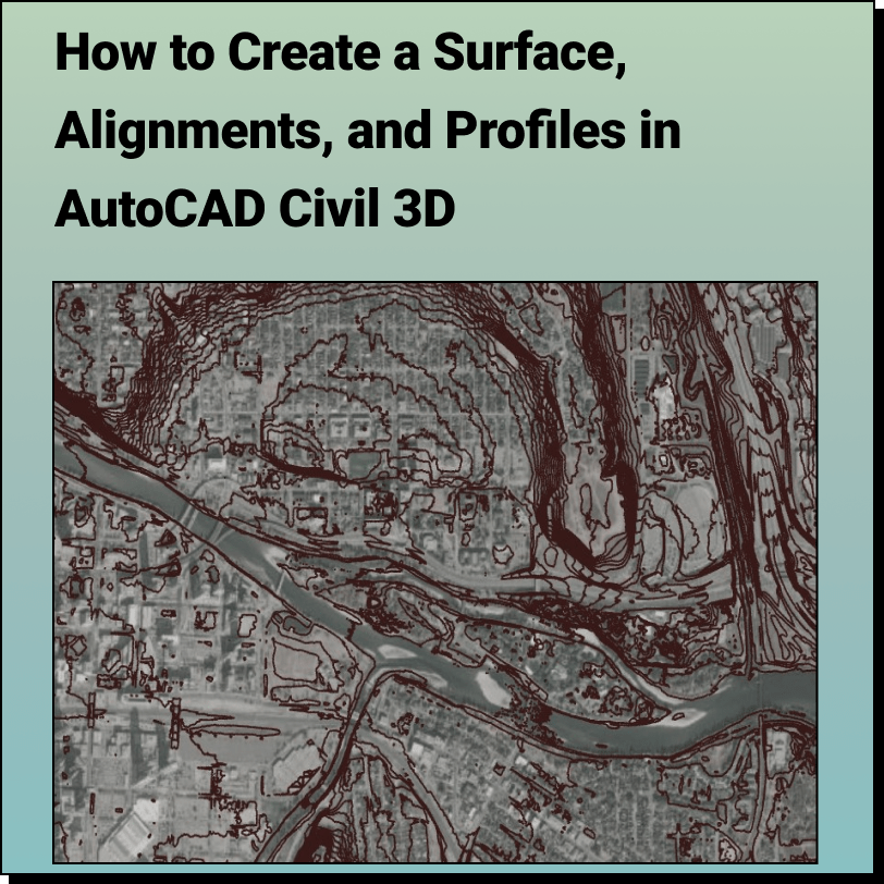
Create a Surface and Profiles Along the Surface in Civil 3D Use Equator to source a Contour Drawing File (.dwg) that can easily be brought
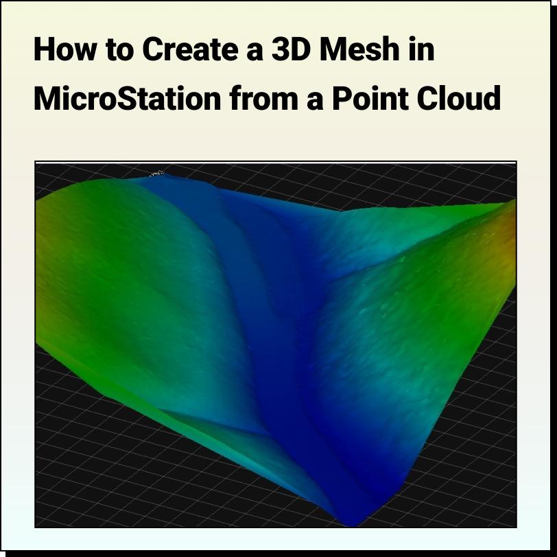
Tutorial: Creating a 3D Mesh from a Point Cloud in Bentley MicroStation In this tutorial, learn how to create a 3D surface mesh in MicroStation
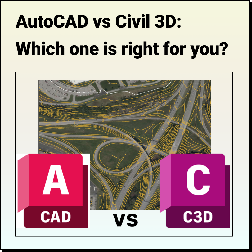
AutoCAD vs Civil 3D Which one is right for you? We have a lot of questions come through our help chat about AutoCAD or
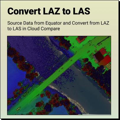
Tutorial: How to Convert LAZ Files to LAS Files Definitions Source LAZ File Convert LAZ to LAS Definitions Point
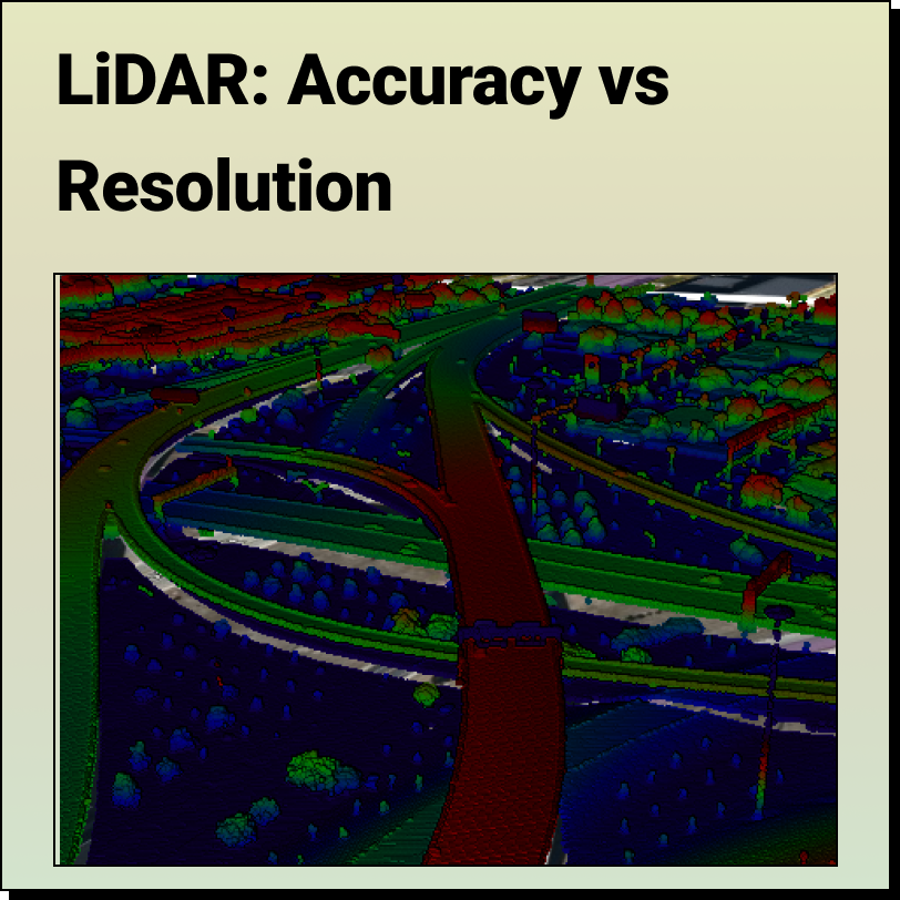
LiDAR - Accuracy vs. Precision Understanding the difference between LiDAR Accuracy and LiDAR Precision LiDAR technology has revolutionized the way we collect and
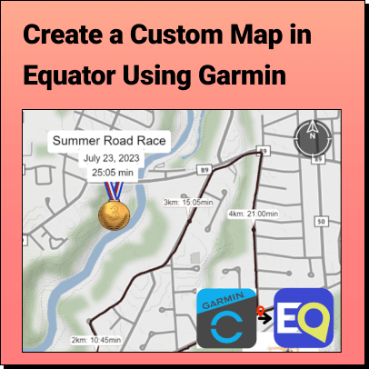
Tutorial: Export Data from Garmin Connect and Import it into Equator Learn how to create a custom map to showcase a special hike, run or ride
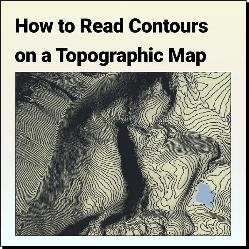
Features of a Topographic Map Topographic maps use contour lines to show different bare earth elevations and landforms such as hills, mountains and valleys. When
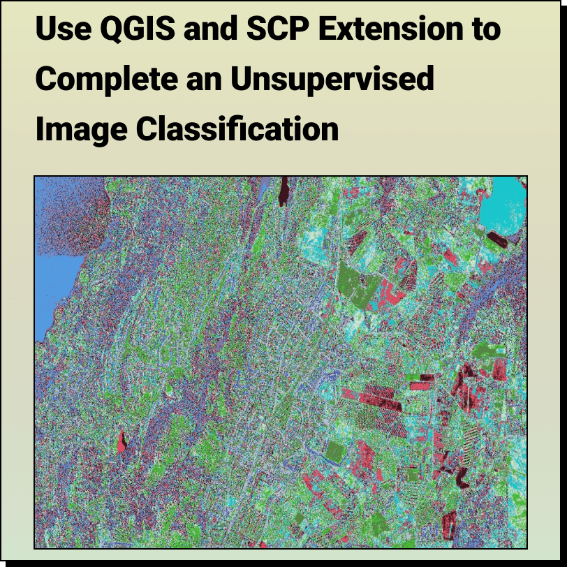
How to Complete an: Unsupervised Image Classification with QGIS and SCP Extension Unsupervised image classification is a remote sensing method used to classify
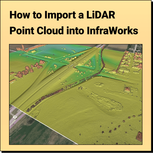
Tutorial: Import Your Point Cloud into InfraWorks Learn how to bring your LiDAR point cloud (.laz) into AutoDesk InfraWorks in a few easy steps.
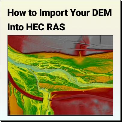
Tutorial: How to Import Your DEM Into HEC RAS Learn how to set your HEC RAS project up and bring your DEM into HEC RAS
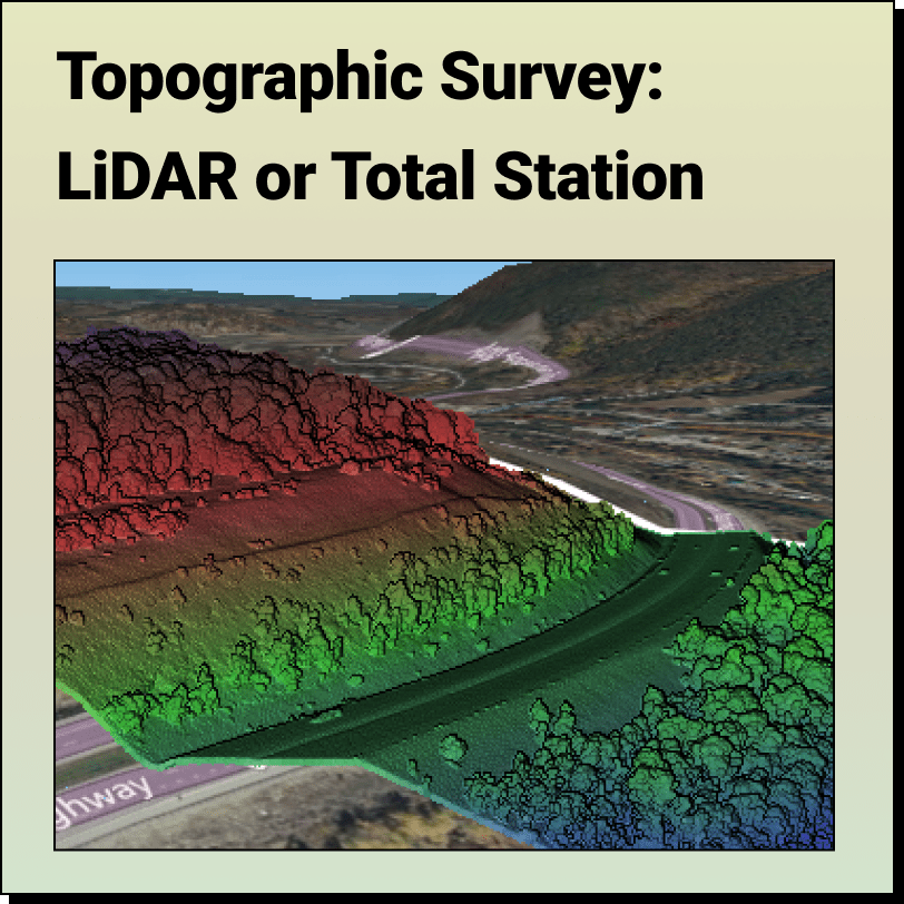
Topographic Surveys: LiDAR or Total Station? Most people think the only way to get an accurate topographic survey is through a total station; here’s why they
Blog HomeEquator Students2024-01-03T15:28:05-05:00