LAND DEVELOPMENT INTELLIGENCE PLATFORM

Win More Work with LiDAR and AI

Software for civil engineering consultants that integrates land data (LiDAR, parcels, topography) and AI to complete proposals and projects faster, and more accurately. 

Trusted by Over 400 Customers

How Does Equator Work?

The Equator platform uses LiDAR and AI to help your team get high-quality proposals and projects out the door faster.

Your new competitive advantage for RFP Responses and Proposals

Scrambling to find the best content for a proposal? Poor understanding of the site? Proposals that sound like ten people wrote them?

Transform the way your team delivers proposals with Equator!

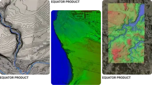
Equator uses built-in high-resolution LiDAR data and AI to help your team understand the site in greater detail and craft stronger proposal narratives.
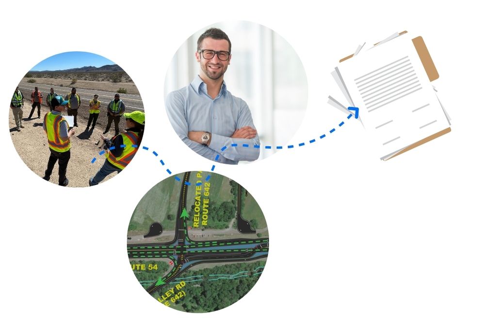
Stronger proposal narratives

Enhance the narrative of your proposal or RFP response by leveraging site data and AI narrative-building functionalities tuned specifically for your firm!

Less scramble, more consistency

Generate a proposal draft in a fraction of the time using AI RFP analysis and content discovery features. Proposals are consistent with the client’s needs and your firm’s brand every time.

Win more projects, faster

Reduce the time it takes to create a high-quality, response that tells the right story. Win work and build a strong backlog, while freeing up your marketing leaders for impactful work.

Our Customers’ Results

↑ 3X Faster Deliverables

Faster proposals, site drawings and existing conditions models

↓ 50% Less Costs

Lower proposal, survey and design costs

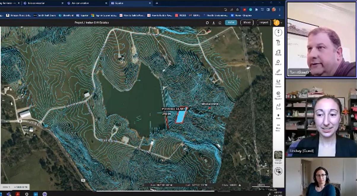
“I’ve got a better design and cut the project costs nearly in half – and that was all from right here at my desk!”

– Tom, Director of Real Estate Development

Tom showing the contours he sourced from Equator in Kentucky

Our Mission

Building communities and infrastructure faster by empowering civil engineers with data, insights, and confidence.
Ready to get started?

Discover your team’s potential with better site data readily available at your fingertips!

Frequently Asked Questions

Equator is mapping and design software with thousands of built-in data sets.  Equator is used by civil engineers, architects, and construction professionals around the world to find, build, and share maps and designs instantly.

What is LiDAR? LiDAR is Light Detection and Ranging technology.  This technology uses a pulsed laser to measure distances from the laser to a surface.  LiDAR is often used for remote sensing applications, for example, measuring the distance to the Earth’s surface for elevation mapping.

Equator indexes data from open data portals around the world.  Many data sets are pulled in automatically through APIs and others are added by our team of GIS experts and geospatial developers.

Click the button at the top of the screen that says “LiDAR Data.” It will take you to the Equator platform where you can create a new account. You can try creating a site and adding contours, point clouds, or DEMs to your site for free.

Equator LDI stands for Equator Land Development Intelligence. It is a solution designed for civil engineering firms that uses artificial intelligence (AI), natural language processing, LiDAR, and a customer’s own content library to create high-quality proposals, documents, and reports based on user input and specific guidelines.

We are currently in the pilot stage of Equator LDI. Are you interested in learning more about Equator LDI or being involved in the pilot stage? Schedule a call with Equator Studios to learn more.

New to Equator and trying to figure out the platform? No problem! Visit our User Guide for more information on the platform.

Interested in our latest guides relating to Proposals, RFPs, and RFQs? Check out our Academy page.

Interested in some of our free tools, such as our proposal template or checklist? Or tutorials using topographic data in various software programs, such as Civil 3D, QGIS, Sketchup, Microstation, or Rhino? Check out our Resources page.