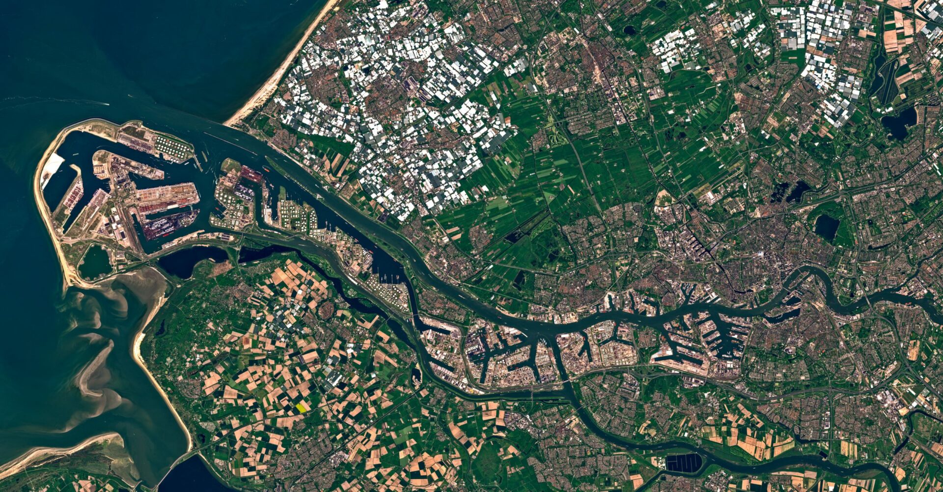
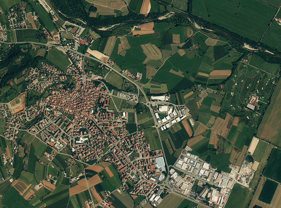
Satellite Imagery
A Product of The ‘Data Revolution’
Satellite Imagery are images of the Earth captured using satellites and other similar aircraft-based sensor technologies. These images are an asset in obtaining crucial information, with constant updates that track the ever changing human footprint across the Earth. It is likely you have come to harness the capabilities of Satellite imagery at one point or another – whether it was using Google Earth to plan your next get-away or using Equator Site Builder to plan your next project! Platforms such as these have ensured that satellite images are not only available to researchers and engineers, but to everyone around the world.

How Does it Work?
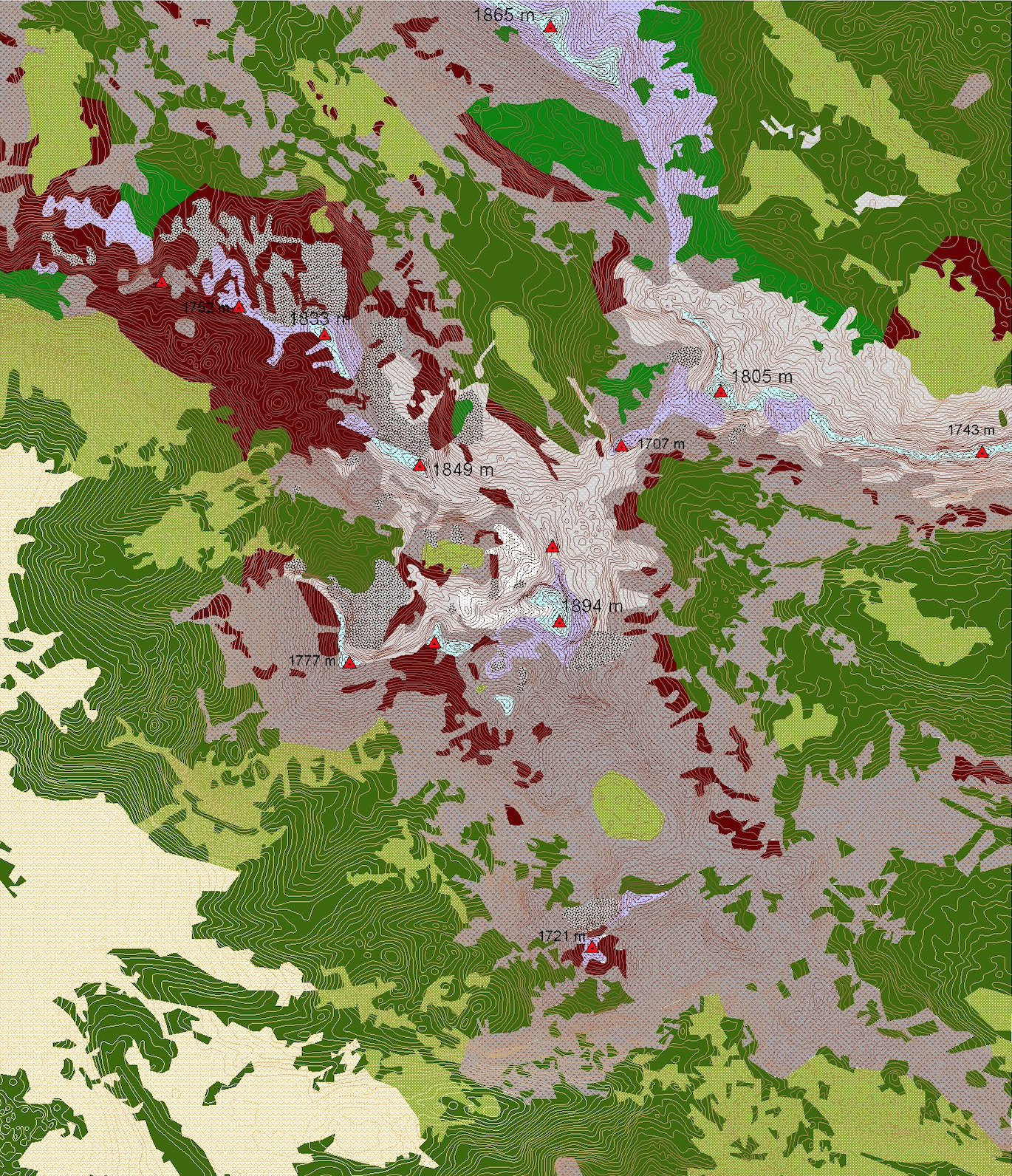
Satellite Imagery is captured using satellites and a variety of other aircraft-based sensor technologies such as drones. These devices make use of sensors that collect electromagnetic radiation being reflected from the Earth’s surface. There are two types of sensors to make note of and these are passive sensors and active sensors. Passive sensors require no energy as it collects radiation emitted from the Sun and reflected by the Earth’s surface. Active sensors – on the other hand – require a significant amount of energy, as it actually emits radiation and analyzes it once it has been reflected back from the Earth’s surface. The varying features on the Earth also possess different albedo levels, which is then reflected in the way satellites process the energy and differentiate between objects; in accordance to the way they react to radiation. It should be noted that satellite images can only be as good as their resolution. Even if a system is able to produce high-resolution images, they must be validated in-person on the ground to ensure accuracy. There have been instances in the past where on-ground validation for certain satellite images did not occur, and when crucial decisions were made based on this inaccurate data; there were very serious consequences.

What is Satellite Imagery Used for?
Satellite imagery has many applications, in a diverse array of fields. One such application is when satellite images are used to track seasonal vegetation change. This information is used to monitor droughts and vegetation, and plays a big role in agricultural, economical, and governmental planning. Satellite imagery is also used to monitor natural disasters and phenomena, such as radiation, volcano eruptions, etc. Satellite images are also used to track human phenomena.
What Format are Satellite Images Saved in?
Below are some of the formats that satellite images are saved in:
HDF
HDF – Hierarchical Data Format – is a file format developed by the National Center for Supercomputing Applications (NCSA), to store and exchange scientific data. It uses programming languages such as C, and Java as interfaces, and is a freely available file format. HDF allows for the storing of raster data such as satellite images, but the file itself ignores any non-raster data.
GeoTIFF
GeoTiff – Geographic Tagged Image File Format – is a raster image file type designed by Dr. Niles Ritter, whilst he was working at Nasa’s Jet Propulsion Laboratory. The GeoTiff format stores satellite imagery, along with projection information such as: coordinate systems, datums, ellipsoids, map projection etc. GeoTiff is an excellent file format as it is compatible with almost all CAD and GIS applications.
JPEG
JPEG is a Lossy Image Compression Format, issued in 1992 by the Joint Photographic Experts Group (JPEG) and approved in 1994. It is a method of compression for photographic images, the degree of which can be adjusted. This means that the format makes possible a tradeoff between the storage size and the image quality. The JPEG format stores satellite imagery but because of the lossy compression method, some of the information contained in the image does get lost.
PNG
PNG – Portable Network Graphics – is an image format that uses Lossless Data Compression. It was originally released in 1996 as an improved replacement to GIFs (Graphics Interchange Format). PNGs provide much more options than GIFs in terms of range of color depth as well as offering greater compression. As PNGs utilize Lossless Data Compression, it makes it an excellent choice for storing temporary images that require further editing, as opposed to JPEG, which is susceptible to generation loss. Therefore, PNG is an excellent image format for handling large Satellite images whilst preserving quality.


