Tutorial: Using Equator and ArcGIS Pro to Detect Objects Using Deep Learning
In this tutorial, you will learn how to use Equator to source an orthoimage, then use ArcGIS Pro and the tools in the Image Analyst Extension to detect and identify objects through deep learning.
Step 1: Source Orthoimage
Step 2: Add Orthoimage to ArcGIS Pro
Step 3: Classify Objects for Deep Learning
Step 4: Train Deep Learning Model
Step 5: Use Model to Detect New Objects
Video Tutorial of Detecting Objects Using Deep Learning in ArcGIS
Step 1: Sourcing Orthoimagery
If you already have an orthoimage, jump down to Step 2. If you need an orthoimage for your project site, follow these steps:
- Sign-in or create an account in Equator
- Search for your site location by using the search bar or zooming into your site
- Create a site boundary using the +NEW SITE button. Select from the default rectangle options or create your own boundary. Do not forget to name your site!
- Go to the Layers menu, select the orthoimage, and click the down arrow to download your orthoimage.
- Your orthoimage will be saved to your downloads folder or whichever folder your downloads save to.
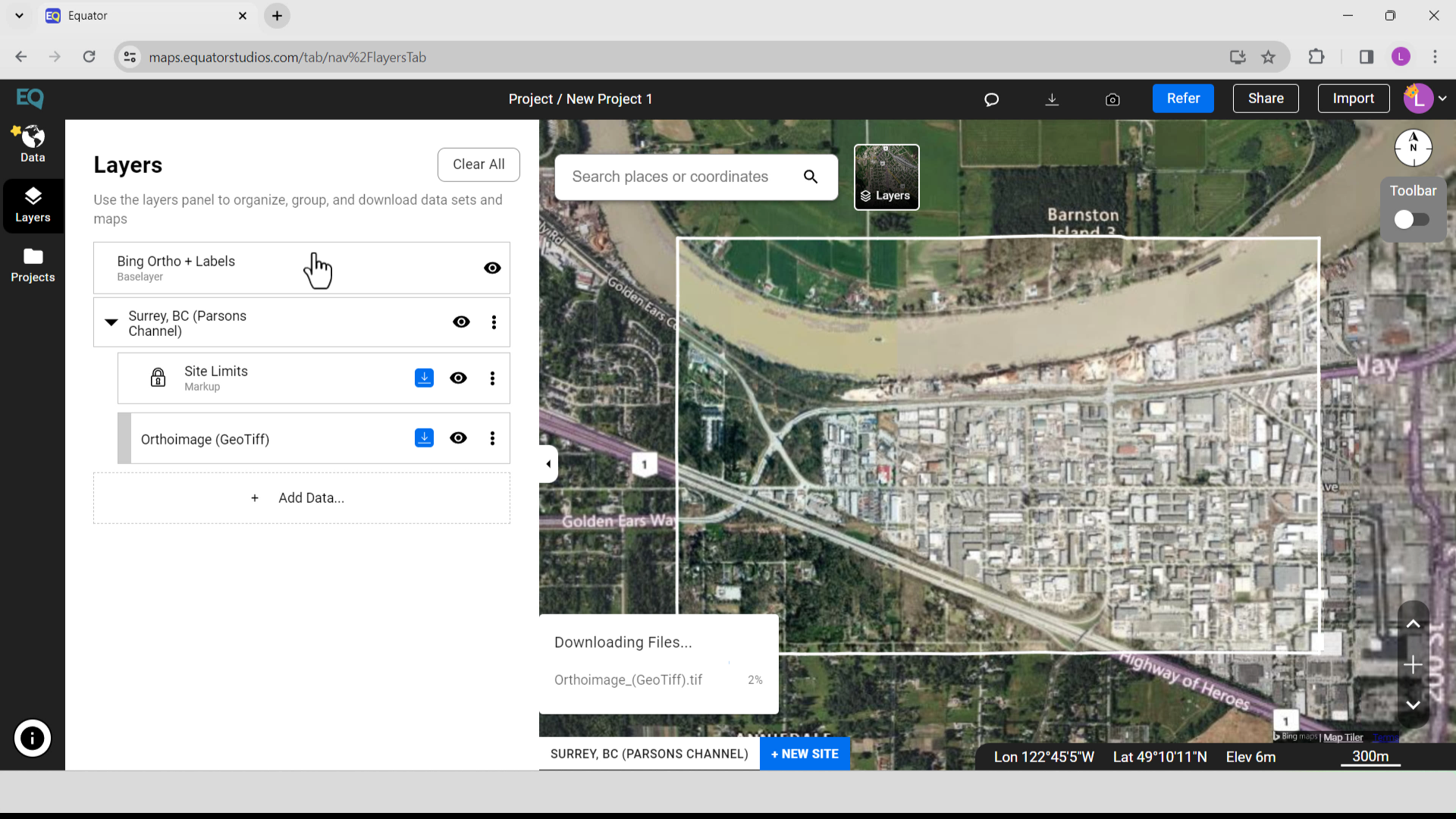
Orthoimage Download from Equator
Step 2: Add Orthoimage to ArcGIS Pro
In this step you will open ArcGIS Pro, create a new map, and add the orthoimage you just downloaded from Equator.
- Open ArcGIS Pro
- In the menu, select New Map > Assign a Name > Select a Location or By Default
- On the top menu, select View > Catalog View, Fix the Panel > Create a Folder to save your Orthoimage
- The dialogue box for Calculating Statistics for the Orthoimage will appear. Click Yes. Statistics are required for your raster and mosaic datasets to perform certain tasks, such as applying a contrast stretch or classifying your data.

ArcGIS Pro Dialog Box for Calculating Statistics for the Orthoimage
Step 3: Classify the Objects for Deep Learning
- On the top Menu > Select Imagery > Symbology > Classification Tools > Label Objects for Deep Learning
- From the Image Classification menu, select any form to create objects or create new classes. In this example we are going to identify pine trees
Step 4: Train Deep Learning Model
-
In the Image Classification menu, go to Export Training Data tab. Change your Output Folder
- Click Run
Step 5: Use Model to Detect New Objects
-
View > Catalog View > Labeled Objects > Orthoimage_GeoTiff_tif > Create a New Folder
- Go to View > Geoprocessing > Image Analyst Tools > Deep Learning > Train Deep Learning Model
- Identify your Input Training Data folder and the folder to save your Output Model (the folder that was just created above). Under Model Parameters, select MaskRCNN (Object Detection)
- Click Run
- Go to View > Geoprocessing > Image Analyst Tools > Deep Learning > Detect Objects Using Deep Learning
- Finally, we are ready to inference new object from our images – Pine Tree. To do that, we will use the Detect Objects Using Deep Learning tool. For the Input Raster, use the Feature Class with Image Attachments that we created in the first step and for the Model, we will use what we created in the Train Deep Learning Model section.
- Click Run

Detect Object Using Deep Learning

New Objects Detected from Deep Learning Model


