Free Civil Engineering Proposal Template
Lindsay2024-04-25T16:58:59-04:00Template Free Civil Engineering Proposal Template Download a
Template Free Civil Engineering Proposal Template Download a
How to Write a Civil Engineering Proposal This post will
Tutorial: Using Equator and ArcGIS Pro to Detect Objects Using Deep Learning
L1, L2, and L5 GPS Signals: What Do They Mean?
Key Mapping and GIS Terms: A Clear and Concise Glossary Updated 2023-08-23 Terms
How Te Miro uses Equator to create maps efficiently for water projects
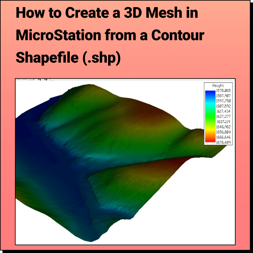
Tutorial: Creating a 3D Mesh from a Contour Shapefile in Bentley MicroStation In
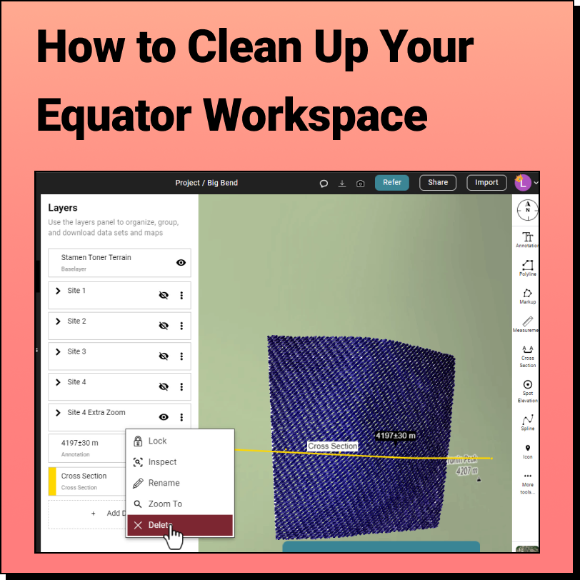
How to Clean Up the Equator Interface We get it, when you're knee
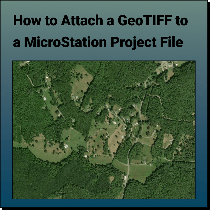
Tutorial: Attaching a RASTER (Orthoimage) to a MicroStation Project File In this tutorial,