The Future of Mapping & Spatial Design
Leveraging real-time collaboration in online mapping to bring remote teams back together
By: Rebecca Swabey
The global health pandemic has highlighted and accelerated radical transformations in many industries. For some, this change has been in the works for a long time. But many others have been forced to innovate in short order.
Through this change, there is one constant that isn’t going away any time soon: the need for human collaboration and communication.
Having worked in the civil engineering industry for a decade, I’ve seen firsthand that in-person collaboration is critical. I have sat around countless tables in the office and on the job site looking over drawings with the client and stakeholder team. In some of my favourite meetings we rolled out preliminary design drawings, and then armed with coloured pens and endless ideas, we would work together to mark-up and improve the design. These meetings represented not only an opportunity to progress on the project, but to connect with the team on a more personal level.

“At Equator, we believe maps are an essential form of communication. Our vision is to make mapping accessible for everyone on the team, regardless of location or level of experience.”
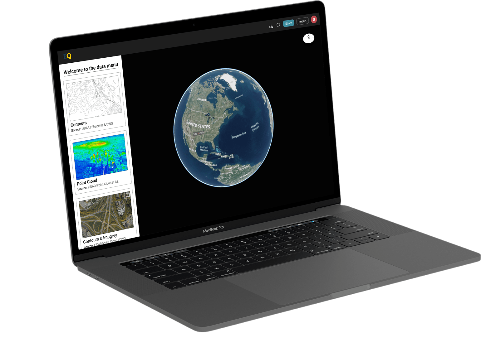
Equator Mapping Platform
“Today, while so many of us have transitioned to remote work, there is a pressing need to recreate the conference room. Not only in the sense of bringing people together virtually, but by recreating an environment where collaboration can again become second nature.”
“Today, while so many of us have transitioned to remote work, there is a pressing need to recreate the conference room. Not only in the sense of bringing people together virtually, but by recreating an environment where collaboration can again become second nature.”
Through the global pandemic, as virtually all white-collared workers transitioned to remote work, there became a pressing need to recreate the conference room. Not only from the perspective of bringing people together virtually, but by recreating an environment where collaboration can again become second nature.
Creating software that allows for real-time collaboration is a rampantly growing technology trend, as companies seek to seamlessly re-create the physical workflows that we’ve all become accustomed to. Consider collaborative design tools like Figma and InVision that have spread through design-centred organizations like wildfire; teams can now collaborate on the entire product design workflow without ever needing to interface in the physical world. Businesses are capitalizing on this opportunity by migrating workflows to remote structures and opening themselves up to a global talent pool.
Recognizing this gap in the civil engineering sector, we have set out to fill the void with Equator. Equator is a 3D, cloud-based CAD mapping platform that allows teams to collaborate in real time. Think Google Docs, but in a map space. Now, stakeholders from around the world can work together and communicate in the same digital map platform.
The future of work that we imagine for design professionals in the Architecture, Engineering, and Construction industries is hands-on, efficient and enjoyable. We understand the value of a fully engaged and supported project team, and what innovations will be required to get there.
At Equator, we believe maps are an essential form of communication. Our vision is to make mapping accessible for everyone on the team, regardless of location or level of experience. We are in the emergence of a new global era that has been accelerated by circumstance, but our goal is to ensure that city builders will not be left behind.
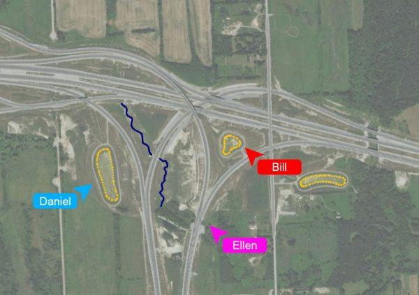
A screenshot of real time collaboration in our mapping platform, two engineers simultaneously marking up a map for their proposal.


