Features of a Topographic Map
Topographic maps use contour lines to show different bare earth elevations and landforms such as hills, mountains and valleys. When reading topographic maps and contours, it is important to remember that contour lines connect points of equal elevation and never intersect. Common features that can be identified through the pattern of contour lines is outlined below.
Contour Intervals
Contour intervals are the vertical distance or difference between contour lines. The interval is based on the size of area being mapped, so the larger the area, the larger the contour interval.
Slope
Slope is an incline or steepness of the terrain. On a topographic map, slopes are indicated by the spacing between the contour lines. If the contour lines are close together, the slope is steep. However, if they are far apart, the slope is gentle.

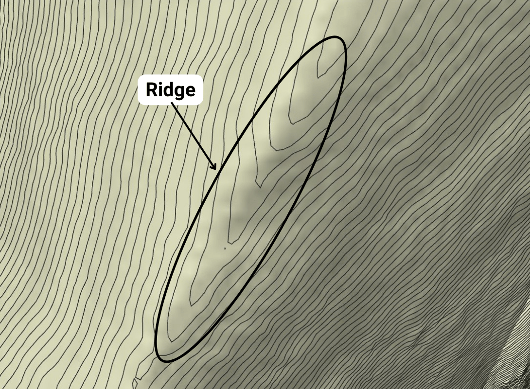
Ridge
A Ridge is a long narrow route that joins a series of high points such as mountain tops. It typically has a narrow route with sharp fall on both sides. On a topographic map, it appears as a pattern of U or V contour lines. If the ridge is gentle and rounded, the contours will appear in a U shape, but if it is sharp, they will appear in a V shape. The tip of the U or V points toward the higher elevation.
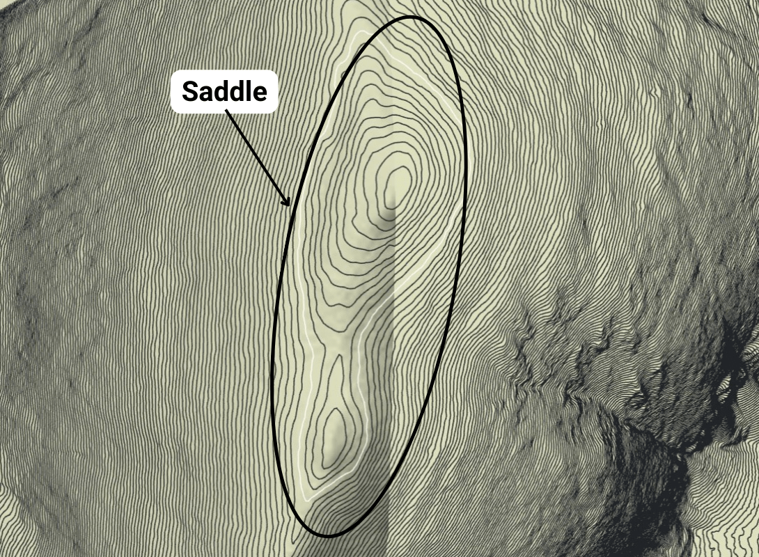
Saddle
A Saddle is the lowest point between two high points on a ridge and connects two peaks or hills. On a topographic map, it appears as a depression with contour lines forming an hourglass or saddle shape.
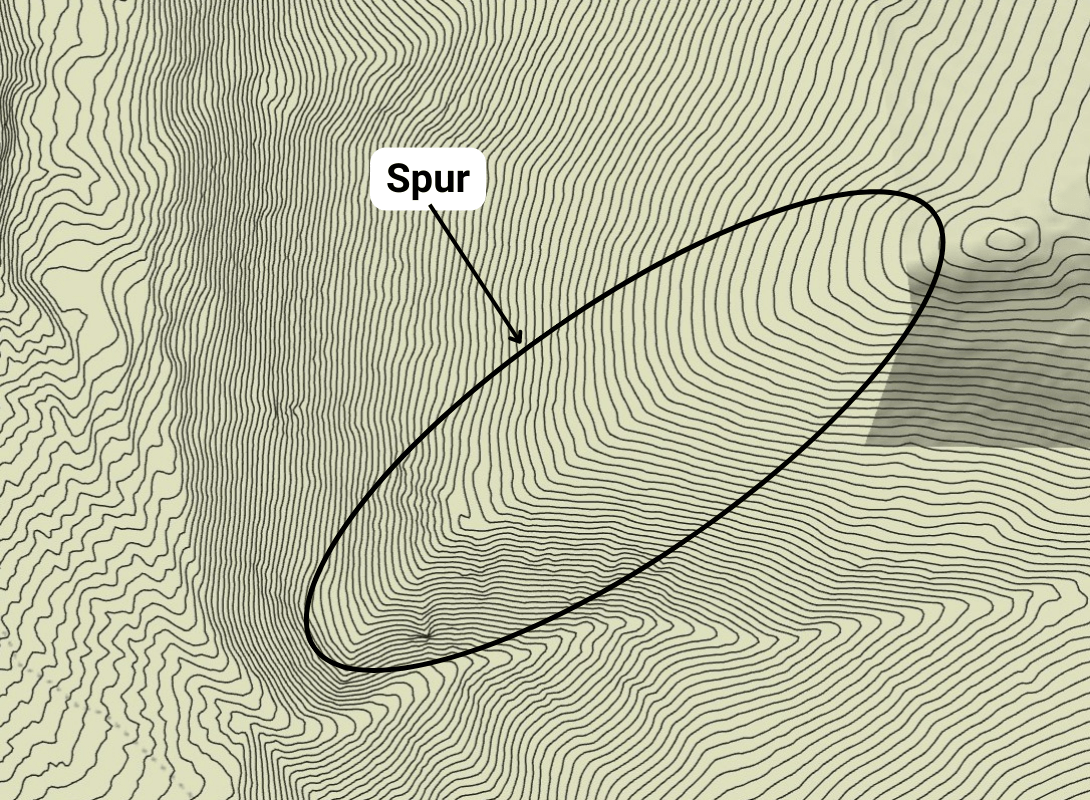
Spur
A Spur is a sloping ridge that runs down to a lower elevation, typically to a creek or river. On a topographic map, it appears as a series of U or V contour lines pointing away from higher ground.
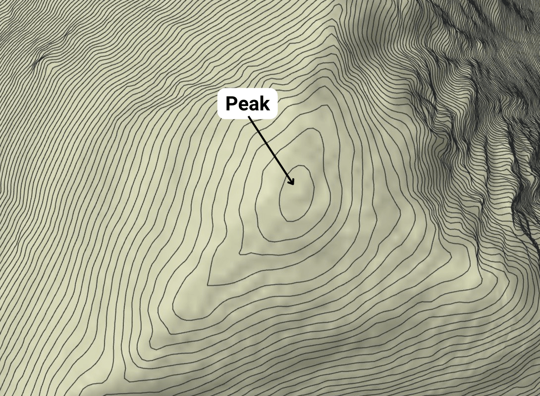
Peak
A Peak is also known as the summit or crest, is the highest point of the mountain or hill. On a topographic map, it appears as a closed contour line (or circles) with progressively smaller concentric circles. Hills and mountains are represented the same way, except a hill is smaller than a mountain.
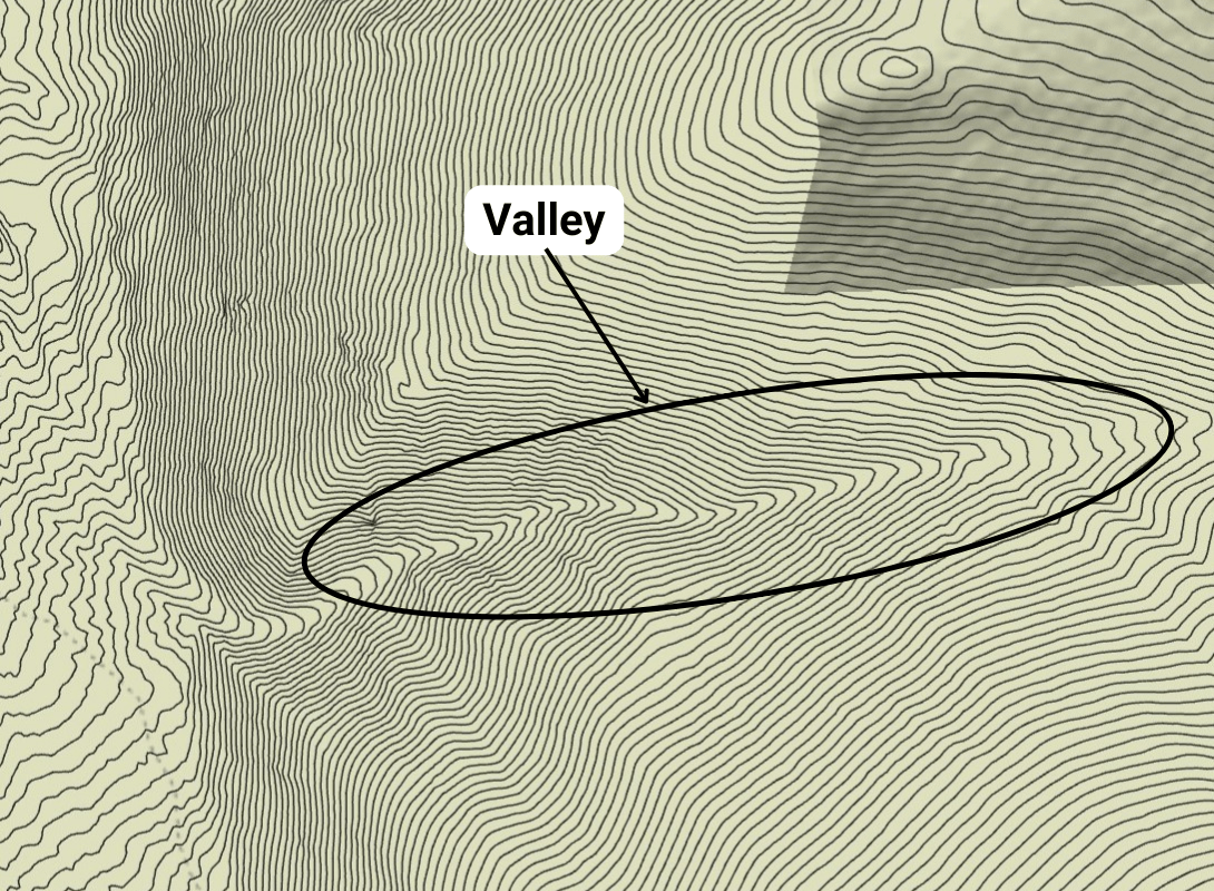
Valley
A Valley is the low area of land between hills or mountains and usually has a river or stream running through it. On a topographic map, it appears as a series of U or V shapes where the wide openings are at the lower elevation.