LiDAR – Accuracy vs. Precision
Understanding the difference between LiDAR Accuracy and LiDAR Precision
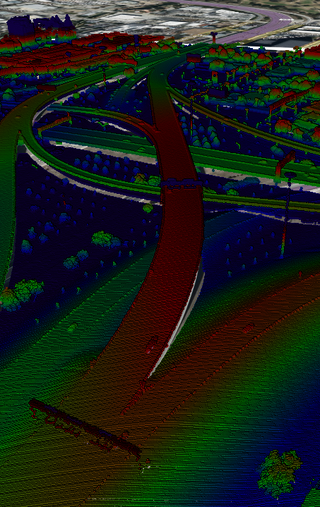
LiDAR technology has revolutionized the way we collect and analyze geospatial data. It’s a powerful tool for so many different applications, from self-driving cars to forestry management and urban planning. To fully leverage the potential of LiDAR technology, it is crucial to understand the difference between accuracy and resolution, as these two aspects play a critical role in the quality of the data obtained. There is a common misconception that accuracy and resolution are the same thing; however, they are distinct concepts.

What is LiDAR Accuracy?
The accuracy of LiDAR is determined by how closely the measured values or collected data align with the true values of the real physical world. It is a measure of the precision and correctness of the LiDAR system in measuring elevations, distances and positions. Accuracy is important in applications where precise measurements are critical, such as in construction or surveying.
Key Factors Affecting LiDAR Accuracy
Sensor Calibration: Properly calibrated LiDAR sensors are essential for accurate data collection. Any errors or misalignments in the sensor can result in inaccuracies.
Georeferencing: Accurate GPS and IMU (Inertial Measurement Unit) data are necessary to georeference LiDAR point clouds to real-world coordinates. Even small errors in these systems can reduce the accuracy.
Environmental Conditions: Factors like weather conditions, temperature, and atmospheric interference can affect LiDAR accuracy. For example, rain, fog, or dust in the air can cause the laser beams to scatter and introduce errors.
What is LiDAR Resolution?
LiDAR resolution refers to the level of identifiable detail in the scanned data. It determines how finely the laser beams sample the surface, creating a dense or sparse point cloud. LiDAR data with high resolution is essential for applications such as forestry management and documenting archaeological sites as it offers a highly detailed representation of the environment.
Key Factors Affecting LiDAR Resolution
Pulse Density: Pulse density, or point density, is the number of LiDAR points collected per unit area. Higher point density results in higher resolution as it captures more detail.
Scanning Density: The scanning pattern and frequency of the LiDAR sensor can also influence resolution. More frequent and closely spaced laser pulses can yield higher resolution data.
Sensor Characteristics: The specifications of the LiDAR sensor, such as its laser beam divergence and scanning mechanism, play a role in determining resolution. A sensor with a narrower laser beam and precise scanning can achieve higher resolution.
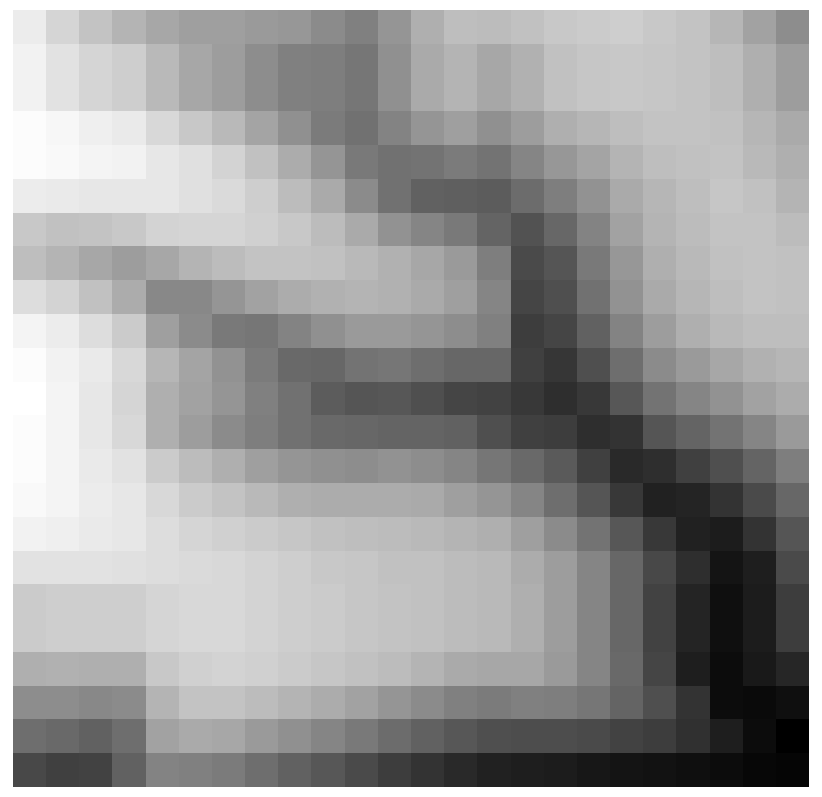
Digital Surface Model (DSM) Created from Low-Resolution LiDAR Point Cloud
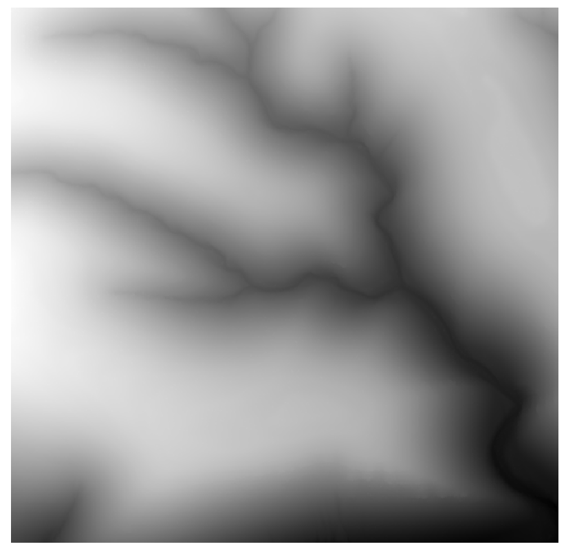
Digital Surface Model (DSM) Created from High-Resolution LiDAR Point Cloud
The Relationship
Accuracy and resolution are distinct concepts; however, they are not entirely independent of one another. While achieving high resolution is essential, it should not come at the cost of accuracy. Achieving both high accuracy and high resolution can be a delicate balancing act. Too much emphasis on resolution might lead to inaccuracies if the LiDAR system’s accuracy components are compromised.
In conclusion, LiDAR technology offers endless possibilities for collecting and analyzing geospatial data. To make the best choice for your specific needs, it is important to understand the difference between accuracy and resolution. Balancing both aspects appropriately will help you obtain the most reliable and detailed data for your projects.


