Topographic Surveys: LiDAR or Total Station?
Most people think the only way to get an accurate topographic survey is through a total station; here’s why they are wrong.
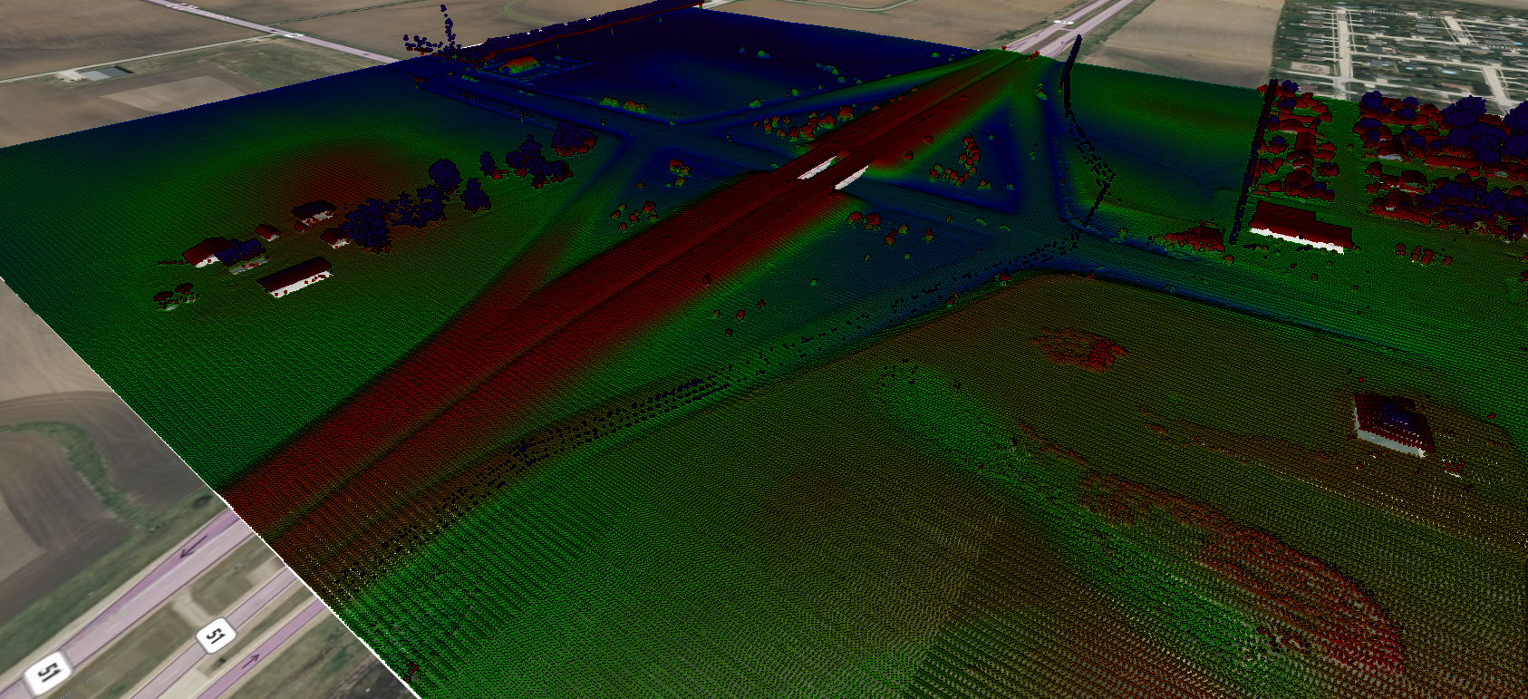
LiDAR Point Cloud from Equator
For decades, total station has been the preferred method for precise and accurate surveys in engineering, architecture, and construction. And it has definitely provided the results we require. Total station survey equipment is comprised of advanced optical instruments that have undergone continuous refinement, resulting in the renowned precision it is recognized for. However, with rapid advancements over the last decade in the world of LiDAR, another way to get a highly accurate topographic survey has emerged.
What is a Topographic Survey?
A topographic survey is a detailed and systematic process of mapping the physical features of a piece of land or terrain. It involves precise measurements and data collection to accurately represent the elevation, contours, natural and man-made features, such as buildings, roads, vegetation, bodies of water, and other significant points on the land’s surface.
Limitations of LiDAR and Total Survey
LiDAR
As with any new technology, LiDAR comes with its limitations. Collecting data is weather dependent. While you can collect LiDAR data during day or night, you cannot operate during rain, snow or fog as water absorbs most near infrared light. It also cannot penetrate through clouds. Skilled operators with previous survey experience are also required to fly the drone or plane, take shots, run base stations, and check benchmarks.
Total Survey
While total station is the “gold standard” and has come with great advancements over the past few decades, it also comes with limitations and safety concerns. The accuracy of a total station survey is lower when measuring longer distances. It is also hard to get accurate ground-level measurements under a forest canopy or under vegetation. There is still a lot of manual work that needs to be done with total station, meaning the survey is susceptible to human error. Surveying using a total station is also time and labour-intensive, and can pose safety concerns to surveyors, especially in and around steep topography. Total stations require line-of-sight between the instrument and the target, which can be obstructed by natural obstacles. This can make data collection cumbersome and sometimes impractical.

Total Station Survey

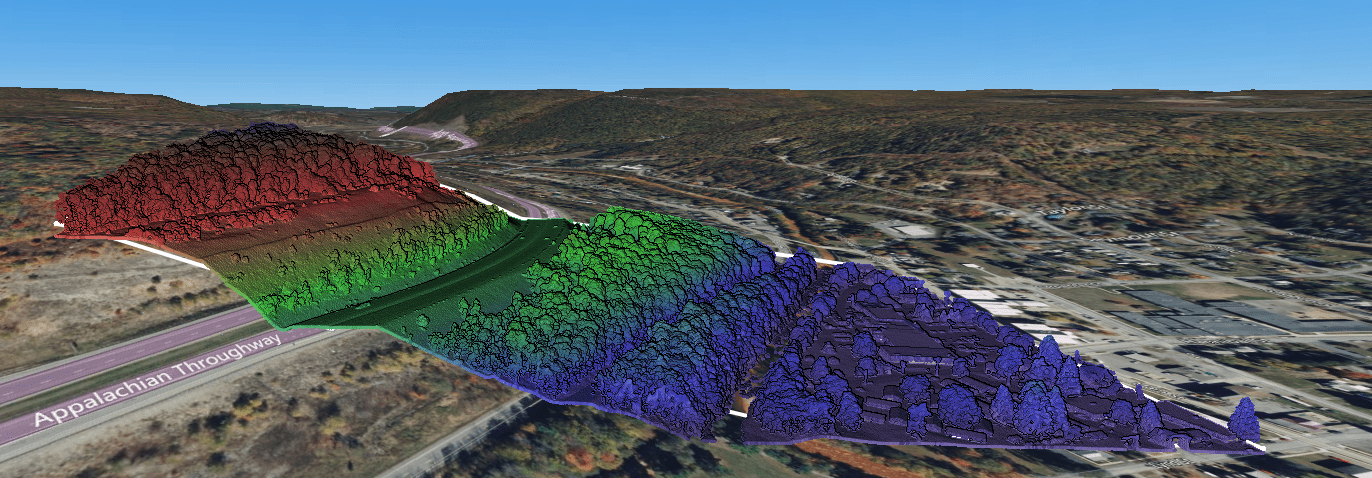
LiDAR Point Cloud
A Comparison in Accuracy
When comparing accuracy of total station to LiDAR, there are a number of factors that need to be considered. Total station can achieve high accuracy, but the precision is often limited by the terrain, weather conditions, and skill of the operator. Accuracy of a LiDAR survey is dependent on the quality and calibration of the system’s scanner, IMU and GNSS components. However, LiDAR technology can achieve a much denser point cloud representation in a shorter time period, which can reduce the error percentage and increase accuracy. This high-density data also allows for more precise mapping of elevation changes, terrain features, and vegetation.
A Comparison in Time, Effort, and Safety
When talking about time, effort, and safety to conduct a survey, LiDAR might be the better option. Conventional topographic surveys using total station requires manual measurements and walking the survey site. This can be both time-consuming and labour-intensive. In contrast, LiDAR scanners can cover large areas quickly and collect data from multiple angles. This efficiency not only reduces surveying time but also minimizes the need for extensive fieldwork, making it a cost-effective solution. LiDAR technology operates from an elevated position, eliminating the need for surveyors to physically navigate challenging terrains, densely vegetated areas, and other hard-to-reach locations. This capability keeps surveyors safer, reduces the time and manpower required for surveys, and streamlines the entire process.
The Future of LiDAR
Ongoing advancements are enhancing the accuracy and resolution of LiDAR scanners, enabling them to capture finer details and smaller objects. The ability to integrate LiDAR with artificial intelligence and photogrammetry holds immense potential for further improvements to the accuracy and efficiency of topographic surveys. Although total station is currently the preferred method for topographic surveys, it won’t be long until more and more surveys are completed using LiDAR technology. This advanced technology will enable surveyors to accomplish more, in less time, while ensuring enhanced safety.
LiDAR Point Cloud


