Blog
Keep up to date with the latest from Equator and the HD mapping world

How to Import an STL file into Blender
User Guide / Import STL into Blender How to Import an STL file into Blender In this tutorial, we will walk you through exporting a Printable Mesh file from Equator, as well as importing it into Blender. To begin, find an area with that you would like to create a

LiDAR Data Processing: The Game-Changing Technology That’s Transforming Industries
LiDAR Data Processing Introduction LiDAR (Light Detection and Ranging) is a remote sensing technology that uses lasers to measure distances and generate high-resolution 3D maps of the Earth's surface. It works by emitting laser pulses and measuring the time it takes for the pulses to return to the LiDAR sensor after reflecting off of objects in the environment. By analyzing the returning laser pulses, LiDAR

How to Make 3D Terrain in SketchUp
How to Make 3D Terrain in SketchUp using Topographic Data Create smooth, accurate SketchUp terrain in 3 easy steps: Source Topographic Data Bring Topography into SketchUp Generate 3D Terrain Step 1: Source Topographic Data When referring to topographic data, we are primarily interested in the elevation or contour data. You might have topographic maps somewhere (either hardcopy

How to open a SHP file in Equator
How to open a SHP file in Equator Opening shapefiles and viewing shapefiles in Equator can be done instantly! Follow this brief guide and you will be able to open and view shapefiles in Equator. Step 1: Opening a SHP file in Equator A SHP file on its own won’t be able to show you anything. First it must

How Jose used Equator to dramatically speed up relief response after hurricane Fiona
How Jose used Equator to dramatically speed up relief response after hurricane Fiona About Jose: Independent surveyor/ designer Location: Based in Puerto Rico Photo 1: Jose surveying on Ian Karlos Culebra Island Jose’s challenge Jose is an independent surveyor working in Puerto Rico. He shared that surveyors and designers are scarce in Puerto Rico, and it can be

GIS – An Overview of Everything GIS
What software do I need to create a GIS? There are many different software options available for creating a GIS. Some of the most popular software programs include: Esri ArcGIS: This is a suite of GIS software products that are widely used in the public and private sectors. It includes tools for mapping, analysis, data management, and visualization. QGIS: This is

Differences Between TIN vs STL
Design Confidently with the World’s Largest LiDAR Library In this short article you will learn about the differences between TIN vs STL files. What is a TIN File? Triangular irregular networks (TIN) are a popular form of digital geographic data that have been used for many years by the GIS and CAD communities. TINs are
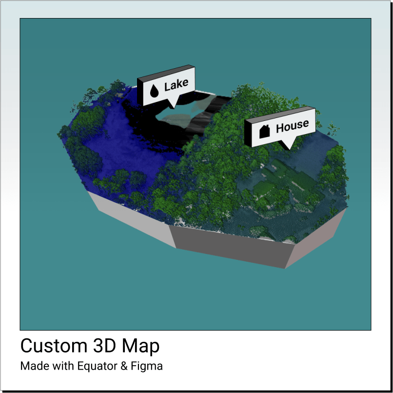
How to use Equator and Figma to create a custom map
The Ultimate Creative Website Builder Try Now In this tutorial, we’ll walk you through how to create a custom map poster or other visual asset using Equator Studios data and styling tools and Figma’s design tools. Begin by choosing a location for your map Open up Equator and use
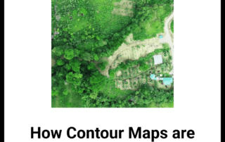
How Contour Maps are Used in Permaculture
How Contour Maps are used in Permaculture In this short article you will learn about Permaculture, as well as how Contour Lines can help in the interpretation of different landscapes. What is Permaculture? Permaculture is creating sustainable systems through the integration of different resources. It is a land design approach that creates no waste by
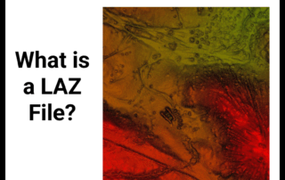
What is a LAZ file?
Design Confidently with the World’s Largest LiDAR Library In this short article you will learn what a LAZ file is. What is a LAZ File? A LAZ file is a compressed LIDAR data file used by several point cloud data programs. LIDAR stands for Light Detection And Ranging, and it is a type of remote

Equator Secures SDTC Funding
Boosting Sustainable Infrastructure Design Efficiency: Equator Secures SDTC Funding Example of a sustainable infrastructure project (Bioswale SWM Installation) that relies on high-resolution data and collaboration (source). Background Equator was founded with a mission to revolutionize the way sustainable infrastructure is designed. We aimed to empower city builders worldwide to share data and designs in real-time, facilitating informed

LiDAR Quality Levels
LiDAR Quality Levels What is LiDAR data? LiDAR is a radar technology that uses light to measure distances. It is often used in conjunction with other remote sensing technologies, such as GPS and aerial photography. There are a number of commercial LiDAR devices available on the market, and the technology is becoming more and more popular among engineers and students. LiDAR data is
How to export USGS LIDAR as a DEM
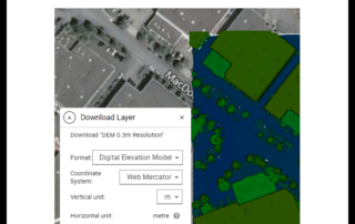
How to export USGS LiDAR as a DEM The easiest way to turn USGS LiDAR into a DEM is to use Equator. Follow the short steps below to learn how you can turn LiDAR into a DEM. Step 1: Locate available USGS LiDAR First, visit Equator at maps.equatorstudios.com. Then, open the Data menu on the left sidebar. Once the

How to import laz file to Civil 3D
How to import a laz file to Civil 3D Currently, there is no way to import laz files directly into AutoDesk Civil 3D. Instead, laz files must be converted into a format that Civil 3D can read, such as RCP/RCS (from AutoDesk Recap), DWG, GeoTIFF, or SHP. This article explains how to convert laz data into Civil 3D supported formats, using industry-standard software.
How to upload a LAZ file to Equator and export it as a DEM
How to upload a LAZ file to Equator and export it as a DEM Do you have your own LAZ file that you need to convert into a DEM so you can complete your analysis? It is actually quite simple to do when you use Equator. Follow the steps below to convert an LAZ into DEM. Open Equator to Convert an LAZ to A DEM
How to convert LAZ to STL in Equator
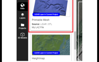
How to convert LAZ to STL in Equator Use Equator to turn your LAZ file into an STL file in only a few short steps. Open Equator Here Step 1: Drag and Drop a LAZ file into Equator First, visit Equator at maps.equatorstudios.com. Then drag and drop your LAZ file from your computer onto the map in Equator. After

Working with units and projections in Equator
User Guide / Working with units and projections Working with units and coordinate systems in Equator View and export elevation data in the right format for your job This article explains how to work with elevation data (contours, LiDAR point clouds, DEMs) in different units and coordinate systems. Tutorial

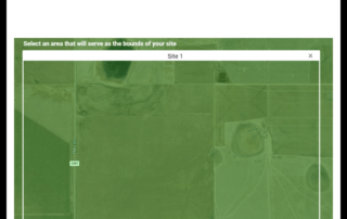
How to Clip a Shapefile in QGIS
How to Clip a Shapefile in QGIS: Obtain a Shapefile Open Shapefile in QGIS Generate a Clip Boundary Clip Input Layer Get Shapefiles for QGIS Step 1 Source the shapefile If you have a shapefile already that you would like to clip, skip to Step 2. If you need to source contour data as a shapefile, you can do

The Top 10 Alternatives to ArcGIS
The Top 10 Alternatives to ArcGIS Find the best GIS platform for your project GIS software is a powerful tool that enables for the presentation, collection, manipulation, management, and analysis of spatial data. It is therefore no surprise that it is used in such a variety of industries ranging from transportation and infrastructure, to environmental planning and disaster response. Currently, ArcGIS is one of the
How to Create a Surface in AutoDesk Civil 3D from a LiDAR Point Cloud
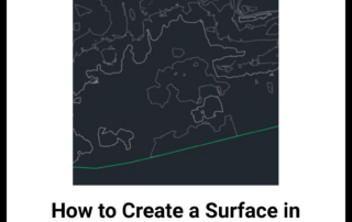
How to Create a Surface in Autodesk Civil 3D from a LiDAR Point Cloud In this article you will learn how to create a 3D surface in Autodesk Civil 3D. To follow along you will need to use: Equator, Autodesk ReCap Pro and Autodesk Civil 3D. Video: Watch the video tutorial below or follow along with the written

Satellite Imagery
Satellite Imagery A Product of The 'Data Revolution' Satellite Imagery are images of the Earth captured using satellites and other similar aircraft-based sensor technologies. These images are an asset in obtaining crucial information, with constant updates that track the ever changing human footprint across the Earth. It is likely you have come to harness the capabilities of Satellite imagery at one point or another – whether
Google Earth Contours vs LiDAR
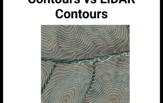
Google Earth Contours vs LiDAR Contours In this article you will learn how to extract contours from Google Earth and from Equator. Then, we will see how they compare to each other. To follow along you will need to use: Google Earth Pro, QGIS and Equator. Video: Watch the video tutorial below, or follow along with the written

How to Calculate Zonal Statistics in QGIS
How to Calculate Zonal Statistics using DEMs and QGIS: Gather Data Calculate Zonal Statistics What are zonal statistics in QGIS? Zonal Statistics calculates statistics for specified zones or cells, such as mean, median, sum, minimum, maximum, or range for each zone. Try Equator Now Step 1 Gather Your Data There is more than one way to acquire zonal

How to download LiDAR data from the USGS earth explorer
How to download LiDAR data from the USGS Earth Explorer? To download LiDAR data from the USGS Earth Explorer, first, check "show where LiDAR is available." Second, define your area of interest by following the instructions on-screen (hold down the Ctrl key). Third, in the right menu panel, open the "Lidar within AOI" drop-down and click on the "LiDAR Point Cloud (LPC)" folder. Finally, select

How to Create a 3D Map in QGIS
How to Create a 3D Map in QGIS in 5 Steps: Upload Data Generate 3D Map View Set Type Adjust Vertical Scale Customize Symbology Find DEMs for QGIS Step 1 Upload Data We begin by uploading our DEM (Digital Elevation Model) from the Equator Site Builder. You may extract your DEM from any source you find appropriate, however, for our purposes